Petina geodata
Petina (Campania) is a seat of a third-order administrative division; located in Italy in Europe/Rome (GMT+2) time zone. With population of 1,178 people, there are 6031 cities with bigger population in this country. Compared to other cities in Italy, 83.9% of cities are located further ↑North; 90% of cities are located further ←West and 87.3% of cities have lower elevation than Petina. Note1


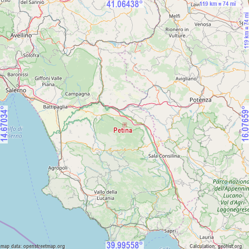
Petina GPS coordinates[2]
40° 31' 55.596" North, 15° 22' 24.456" East
| Map corner | latitude | longitude |
|---|---|---|
| Upper-left | 41.06438°, | 14.67034° |
| Center: | 40.53211°, | 15.37346° |
| Lower-right: | 39.99558°, | 16.07659° |
| Map W x H: | 118.8×118.8 km | = 73.8×73.8mi |
| max Lat: | 47.04031° ⇑83.9% North |
| Petina: | 40.53211° |
| min Lat: | ⇓16.1% South 35.50142° |
| min Long | Petina | max Long |
| 6.69888° | 15.37346° | 18.48682° |
| W 90%⇐ | ⇒10% E |
Elevation
Elevation of Petina is 660 m = 2165 ft, and this is 353.3 m = 1159 ft above average elevation for this country.
| Max E: |
2085 m = 6841 ft | 12.7% |
| Petina | 660 m 2165 ft | |
| Avg. | 306.7 m = 1006 ft | |
Min E: |
-4 m = -13 ft | 87.3% |
See also: Italy elevation on elevation.city.
Geographical zone
Petina is located in North temperate zone (between Tropic of Cancer and the Arctic Circle). Distance of this Northern Tropic circle is 1900.8 km =1181.1 mi to South.| Distance of | km | miles | from Petina |
|---|---|---|---|
| North Pole | 5500.3 | 3417.7 | to North |
| Arctic Circle | 2894.4 | 1798.5 | to North |
| Tropic Cancer | 1900.8 | 1181.1 | to South |
| Equator | 4506.7 | 2800.3 | to South |


Nearby cities:
15 places around Petina: (largest is in red/bold)
• Ariola
11.8 km =7.3 mi,  25°
25°
• Auletta
5.3 km =3.3 mi,  52°
52°
• Buccino
11.6 km =7.2 mi,  3°
3°
• Caggiano
10.9 km =6.8 mi,  72°
72°
• Castelcivita
12.6 km =7.8 mi,  250°
250°
• Corleto Monforte
10.5 km =6.5 mi,  176°
176°
• Ottati
9.1 km =5.7 mi,  212°
212°
• Pertosa
6.6 km =4.1 mi,  78°
78°
• Polla
10.6 km =6.6 mi,  100°
100°
• Postiglione
12.3 km =7.6 mi,  284°
284°
• Salvitelle
9.6 km =6 mi, 47°
• Sant'Angelo A Fasanella
8.8 km =5.5 mi,  198°
198°
• Sant'Arsenio
11.5 km =7.1 mi,  125°
125°
• Scalo Romagnano al Monte
10.7 km =6.6 mi,  35°
35°
• Sicignano degli Alburni
6.5 km =4 mi,  297°
297°
Sources, notices
• [Note1] Compared only with cities in Italy existing in our database
• [Src1] Map data: © OpenStreetMap contributors (CC-BY-SA)
• [Src2] Other city data from geonames.org with taken over terms of usage.
• [Src3] Geographical zone / Annual Mean Temperature by Robert A. Rohde @ Wikipedia
