Spanish Town geodata
Spanish Town (Saint Catherine) is a seat of a first-order administrative division; located in Jamaica in America/Jamaica (GMT-5) time zone. With population of 145,018 people, there are 2 cities with bigger population in this country. Compared to other cities in Jamaica, 75.8% of cities are located further ↑North; 69.2% of cities are located further ←West and 71.4% of cities have higher elevation than Spanish Town. Note1


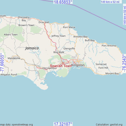
Spanish Town GPS coordinates[2]
17° 59' 27.852" North, 76° 57' 26.712" West
| Map corner | latitude | longitude |
|---|---|---|
| Upper-left | 18.65853°, | -77.66055° |
| Center: | 17.99107°, | -76.95742° |
| Lower-right: | 17.32107°, | -76.2543° |
| Map W x H: | 148.7×148.7 km | = 92.4×92.4mi |
| max Lat: | 18.49358° ⇑75.8% North |
| Spanish Town: | 17.99107° |
| min Lat: | ⇓24.2% South 17.774° |
| min Long | Spanish Town | max Long |
| -78.3481° | -76.95742° | -76.24864° |
| W 69.2%⇐ | ⇒30.8% E |
Elevation
Elevation of Spanish Town is 31 m = 102 ft, and this is 183.4 m = 602 ft below average elevation for this country.
| Max E: |
944 m = 3097 ft | 71.4% |
| Avg. | 214.4 m = 703 ft | |
| Spanish Town | 31 m = 102 ft | |
Min E: |
1 m = 3 ft | 28.6% |
See also: Spanish Town elevation on elevation.city.
Geographical zone
Spanish Town is located in North Torrid zone (between Equator and Tropic of Cancer). Distance of this Northern Tropic circle is 605.5 km =376.2 mi to North.| Distance of | km | miles | from Spanish Town |
|---|---|---|---|
| North Pole | 8006.6 | 4975.1 | to North |
| Arctic Circle | 5400.8 | 3355.9 | to North |
| Tropic Cancer | 605.5 | 376.2 | to North |
| Equator | 2000.4 | 1243 | to South |


Nearby cities:
15 places around Spanish Town: (largest is in red/bold)
• Bog Walk
13.3 km =8.3 mi,  337°
337°
• Constant Spring
18.5 km =11.5 mi,  69°
69°
• Half Way Tree
16.9 km =10.5 mi,  81°
81°
• Kingston
17.3 km =10.7 mi,  87°
87°
• Linstead
18 km =11.2 mi,  334°
334°
• Lluidas Vale
25.1 km =15.6 mi,  306°
306°
• Mona Heights
21.9 km =13.6 mi, 83°
• New Kingston
18.5 km =11.5 mi, 84°
• Old Harbour
17 km =10.6 mi,  251°
251°
• Old Harbour Bay
17.4 km =10.8 mi,  238°
238°
• Point Hill
19.3 km =12 mi,  304°
304°
• Port Royal
13.7 km =8.5 mi,  115°
115°
• Portmore
9.2 km =5.7 mi, 119°
• Riversdale
19.4 km =12.1 mi,  357°
357°
• Stony Hill
20.7 km =12.9 mi,  61°
61°
Sources, notices
• [Note1] Compared only with cities in Jamaica existing in our database
• [Src1] Map data: © OpenStreetMap contributors (CC-BY-SA)
• [Src2] Other city data from geonames.org with taken over terms of usage.
• [Src3] Geographical zone / Annual Mean Temperature by Robert A. Rohde @ Wikipedia
