Ţabaqat Faḩl geodata
Ţabaqat Faḩl (Irbid) is a populated place; located in Jordan in Asia/Amman (GMT+3) time zone. With population of 1,000 people, there are 81 cities with bigger population in this country. Compared to other cities in Jordan, 77.5% of cities are located further ↓South; 87% of cities are located further →East and 94.2% of cities have higher elevation than Ţabaqat Faḩl. Note1


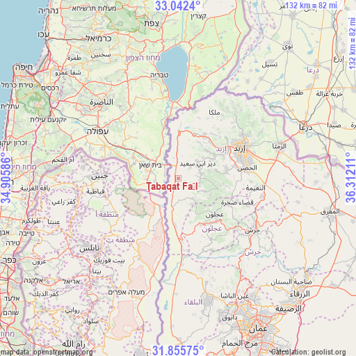
Ţabaqat Faḩl GPS coordinates[2]
32° 27' 3.708" North, 35° 36' 32.328" East
| Map corner | latitude | longitude |
|---|---|---|
| Upper-left | 33.0424°, | 34.90586° |
| Center: | 32.45103°, | 35.60898° |
| Lower-right: | 31.85575°, | 36.31211° |
| Map W x H: | 131.9×131.9 km | = 82×82mi |
| max Lat: | 33.31405° ⇑22.5% North |
| Ţabaqat Faḩl: | 32.45103° |
| min Lat: | ⇓77.5% South 29.40842° |
| min Long | Ţabaqat Faḩl | max Long |
| 34.97918° | 35.60898° | 38.70342° |
| W 13%⇐ | ⇒87% E |
Elevation
Elevation of Ţabaqat Faḩl is -59 m = -194 ft, and this is 744.7 m = 2443 ft below average elevation for this country.
| Max E: |
1440 m = 4724 ft | 94.2% |
| Avg. | 685.7 m = 2250 ft | |
| Ţabaqat Faḩl | -59 m = -194 ft | |
Min E: |
-366 m = -1201 ft | 5.8% |
See also: Jordan elevation on elevation.city.
Geographical zone
Ţabaqat Faḩl is located in North temperate zone (between Tropic of Cancer and the Arctic Circle). Distance of this Northern Tropic circle is 1002.3 km =622.8 mi to South.| Distance of | km | miles | from Ţabaqat Faḩl |
|---|---|---|---|
| North Pole | 6398.8 | 3976 | to North |
| Arctic Circle | 3793 | 2356.9 | to North |
| Tropic Cancer | 1002.3 | 622.8 | to South |
| Equator | 3608.2 | 2242 | to South |


Nearby cities:
15 places around Ţabaqat Faḩl: (largest is in red/bold)
• Al Mazār ash Shamālī
17.8 km =11.1 mi,  83°
83°
• Ash Shūnah ash Shamālīyah
18.8 km =11.7 mi,  1°
1°
• Aţ Ţayyibah
14.4 km =8.9 mi,  44°
44°
• Bayt Yāfā
18.4 km =11.4 mi,  64°
64°
• Bayt Īdis
8.5 km =5.3 mi,  100°
100°
• Dayr Abū Sa‘īd
9 km =5.6 mi,  54°
54°
• Dayr Yūsuf
18 km =11.2 mi, 77°
• Judita
10.5 km =6.5 mi,  117°
117°
• Kafr Abīl
6.3 km =3.9 mi,  126°
126°
• Qumaym
17.9 km =11.1 mi, 41°
• Tibnah
11.7 km =7.3 mi, 76°
• Waqqāş
10.1 km =6.3 mi,  357°
357°
• Şammā
15.3 km =9.5 mi,  29°
29°
• Ḩalāwah
8.9 km =5.5 mi,  146°
146°
• ‘Irjān
13.3 km =8.3 mi, 118°
Sources, notices
• [Note1] Compared only with cities in Jordan existing in our database
• [Src1] Map data: © OpenStreetMap contributors (CC-BY-SA)
• [Src2] Other city data from geonames.org with taken over terms of usage.
• [Src3] Geographical zone / Annual Mean Temperature by Robert A. Rohde @ Wikipedia
