Ḩalāwah geodata
Ḩalāwah (Ajlun) is a populated place; located in Jordan in Asia/Amman (GMT+3) time zone. With population of 5,376 people, there are 60 cities with bigger population in this country. Compared to other cities in Jordan, 71.7% of cities are located further ↓South; 81.9% of cities are located further →East and 86.2% of cities have higher elevation than Ḩalāwah. Note1


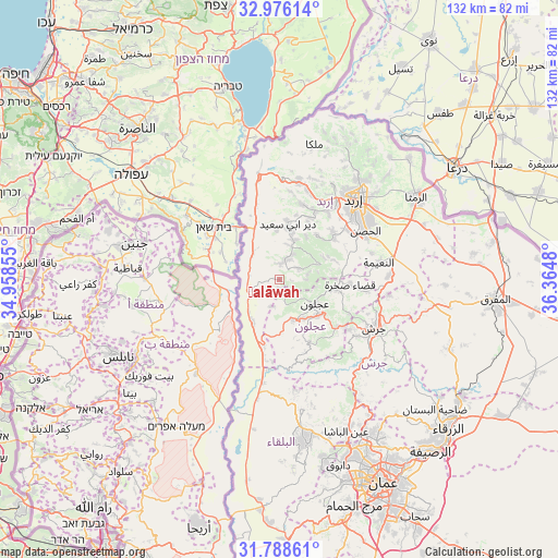
Ḩalāwah GPS coordinates[2]
32° 23' 3.588" North, 35° 39' 42.012" East
| Map corner | latitude | longitude |
|---|---|---|
| Upper-left | 32.97614°, | 34.95855° |
| Center: | 32.38433°, | 35.66167° |
| Lower-right: | 31.78861°, | 36.3648° |
| Map W x H: | 132×132 km | = 82×82mi |
| max Lat: | 33.31405° ⇑28.3% North |
| Ḩalāwah: | 32.38433° |
| min Lat: | ⇓71.7% South 29.40842° |
| min Long | Ḩalāwah | max Long |
| 34.97918° | 35.66167° | 38.70342° |
| W 18.1%⇐ | ⇒81.9% E |
Elevation
Elevation of Ḩalāwah is 407 m = 1335 ft, and this is 278.7 m = 914 ft below average elevation for this country.
| Max E: |
1440 m = 4724 ft | 86.2% |
| Avg. | 685.7 m = 2250 ft | |
| Ḩalāwah | 407 m = 1335 ft | |
Min E: |
-366 m = -1201 ft | 13.8% |
See also: Jordan elevation on elevation.city.
Geographical zone
Ḩalāwah is located in North temperate zone (between Tropic of Cancer and the Arctic Circle). Distance of this Northern Tropic circle is 994.9 km =618.2 mi to South.| Distance of | km | miles | from Ḩalāwah |
|---|---|---|---|
| North Pole | 6406.3 | 3980.7 | to North |
| Arctic Circle | 3800.4 | 2361.5 | to North |
| Tropic Cancer | 994.9 | 618.2 | to South |
| Equator | 3600.8 | 2237.4 | to South |


Nearby cities:
15 places around Ḩalāwah: (largest is in red/bold)
• Al Mazār ash Shamālī
15.9 km =9.9 mi,  52°
52°
• Bayt Īdis
6.8 km =4.2 mi,  29°
29°
• Dayr Abū Sa‘īd
12.9 km =8 mi,  10°
10°
• Dayr Yūsuf
17 km =10.6 mi, 47°
• Judita
5.1 km =3.2 mi,  58°
58°
• Kafr Abīl
3.7 km =2.3 mi,  2°
2°
• Kufrinjah
10.4 km =6.5 mi,  158°
158°
• Kurayyimah
13.4 km =8.3 mi,  205°
205°
• Tibnah
12 km =7.5 mi, 32°
• Şakhrah
17.1 km =10.6 mi,  95°
95°
• Ţabaqat Faḩl
8.9 km =5.5 mi,  326°
326°
• ‘Ajlūn
10.3 km =6.4 mi,  123°
123°
• ‘Anjarah
12.4 km =7.7 mi,  134°
134°
• ‘Ayn Jannah
11.1 km =6.9 mi, 119°
• ‘Irjān
6.8 km =4.2 mi,  80°
80°
Sources, notices
• [Note1] Compared only with cities in Jordan existing in our database
• [Src1] Map data: © OpenStreetMap contributors (CC-BY-SA)
• [Src2] Other city data from geonames.org with taken over terms of usage.
• [Src3] Geographical zone / Annual Mean Temperature by Robert A. Rohde @ Wikipedia
