Ureshinomachi-shimojuku geodata
Ureshinomachi-shimojuku (Saga) is a populated place; located in Japan in Asia/Tokyo (GMT+9) time zone. With population of 18,953 people, there are 710 cities with bigger population in this country. Compared to other cities in Japan, 90.1% of cities are located further ↑North; 96.9% of cities are located further →East and 64.2% of cities have lower elevation than Ureshinomachi-shimojuku. Note1
Current local time in Ureshinomachi-shimojuku:
01:48 AM, ThursdayDifference from your time zone: hours


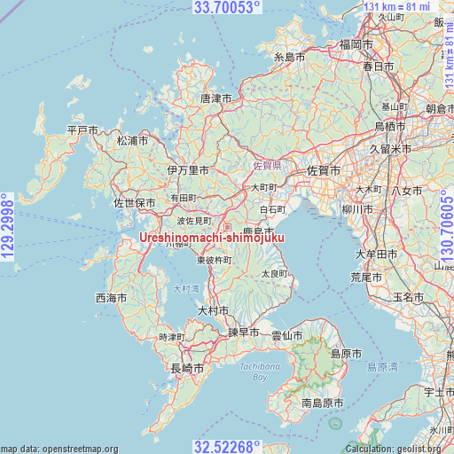
Ureshinomachi-shimojuku GPS coordinates[2]
33° 6' 48.888" North, 130° 0' 10.512" East
| Map corner | latitude | longitude |
|---|---|---|
| Upper-left | 33.70053°, | 129.2998° |
| Center: | 33.11358°, | 130.00292° |
| Lower-right: | 32.52268°, | 130.70605° |
| Map W x H: | 131×131 km | = 81.4×81.4mi |
| max Lat: | 45.40944° ⇑90.1% North |
| Ureshinomachi-shimojuku: | 33.11358° |
| min Lat: | ⇓9.9% South 24.34478° |
| min Long | Ureshinomachi-s | max Long |
| 123° | 130.00292° | 145.575° |
| W 3.1%⇐ | ⇒96.9% E |
Elevation
Elevation of Ureshinomachi-shimojuku is 56 m = 184 ft, and this is 28.6 m = 94 ft below average elevation for this country.
| Max E: |
1086 m = 3563 ft | 35.8% |
| Avg. | 84.6 m = 278 ft | |
| Ureshinomachi-shimojuku | 56 m = 184 ft | |
Min E: |
-2 m = -7 ft | 64.2% |
See also: Japan elevation on elevation.city.
Geographical zone
Ureshinomachi-shimojuku is located in North temperate zone (between Tropic of Cancer and the Arctic Circle). Distance of this Northern Tropic circle is 1076 km =668.6 mi to South.| Distance of | km | miles | from Ureshinomachi-shimojuku |
|---|---|---|---|
| North Pole | 6325.2 | 3930.3 | to North |
| Arctic Circle | 3719.3 | 2311.1 | to North |
| Tropic Cancer | 1076 | 668.6 | to South |
| Equator | 3681.9 | 2287.8 | to South |


Nearby cities:
15 places around Ureshinomachi-shimojuku: (largest is in red/bold)
• Imari
22.3 km =13.9 mi,  331°
331°
• Imarichō-kō
21.2 km =13.2 mi, 327°
• Isahaya
30.5 km =19 mi,  172°
172°
• Kashima
8.2 km =5.1 mi,  95°
95°
• Obita
34.8 km =21.6 mi,  198°
198°
• Ogi
25.7 km =16 mi,  43°
43°
• Saga
30.7 km =19.1 mi,  64°
64°
• Saikai
33.3 km =20.7 mi,  244°
244°
• Sasebo
26.6 km =16.5 mi,  283°
283°
• Takeo
8.8 km =5.5 mi,  6°
6°
• Takeochō-takeo
8.7 km =5.4 mi, 11°
• Taku
20.7 km =12.9 mi,  28°
28°
• Togitsu
34.3 km =21.3 mi, 204°
• Ureshino
5.6 km =3.5 mi, 64°
• Ōmura
21.9 km =13.6 mi,  192°
192°
Sources, notices
• [Note1] Compared only with cities in Japan existing in our database
• [Src1] Map data: © OpenStreetMap contributors (CC-BY-SA)
• [Src2] Other city data from geonames.org with taken over terms of usage.
• [Src3] Geographical zone / Annual Mean Temperature by Robert A. Rohde @ Wikipedia
