Isahaya geodata
Isahaya (Nagasaki) is a seat of a second-order administrative division; located in Japan in Asia/Tokyo (GMT+9) time zone. With population of 97,371 people, there are 206 cities with bigger population in this country. Compared to other cities in Japan, 92.1% of cities are located further ↑North; 96.5% of cities are located further →East and 76.9% of cities have lower elevation than Isahaya. Note1


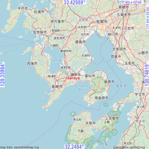
Isahaya GPS coordinates[2]
32° 50' 27.996" North, 130° 2' 35.016" East
| Map corner | latitude | longitude |
|---|---|---|
| Upper-left | 33.42989°, | 129.33994° |
| Center: | 32.84111°, | 130.04306° |
| Lower-right: | 32.2484°, | 130.74619° |
| Map W x H: | 131.4×131.4 km | = 81.6×81.6mi |
| max Lat: | 45.40944° ⇑92.1% North |
| Isahaya: | 32.84111° |
| min Lat: | ⇓7.9% South 24.34478° |
| min Long | Isahaya | max Long |
| 123° | 130.04306° | 145.575° |
| W 3.5%⇐ | ⇒96.5% E |
Elevation
Elevation of Isahaya is 104 m = 341 ft, and this is 19.4 m = 64 ft above average elevation for this country.
| Max E: |
1086 m = 3563 ft | 23.1% |
| Isahaya | 104 m 341 ft | |
| Avg. | 84.6 m = 278 ft | |
Min E: |
-2 m = -7 ft | 76.9% |
See also: Isahaya elevation on elevation.city.
Geographical zone
Isahaya is located in North temperate zone (between Tropic of Cancer and the Arctic Circle). Distance of this Northern Tropic circle is 1045.7 km =649.8 mi to South.| Distance of | km | miles | from Isahaya |
|---|---|---|---|
| North Pole | 6355.5 | 3949.1 | to North |
| Arctic Circle | 3749.6 | 2329.9 | to North |
| Tropic Cancer | 1045.7 | 649.8 | to South |
| Equator | 3651.6 | 2269 | to South |


Nearby cities:
15 places around Isahaya: (largest is in red/bold)
• Arao
40.6 km =25.2 mi,  67°
67°
• Kashima
29.8 km =18.5 mi,  8°
8°
• Minamishimabara
28.1 km =17.5 mi,  131°
131°
• Nagasaki
18 km =11.2 mi,  235°
235°
• Obita
15.2 km =9.4 mi,  259°
259°
• Saikai
37.3 km =23.2 mi,  295°
295°
• Shimabara
30.9 km =19.2 mi,  101°
101°
• Takeo
39.1 km =24.3 mi,  355°
355°
• Takeochō-takeo
38.9 km =24.2 mi, 356°
• Togitsu
18.1 km =11.2 mi,  267°
267°
• Unzen
20.7 km =12.9 mi,  112°
112°
• Ureshino
32.7 km =20.3 mi,  2°
2°
• Ureshinomachi-shimojuku
30.5 km =19 mi,  352°
352°
• Ōmura
12.2 km =7.6 mi,  316°
316°
• Ōmuta
43.6 km =27.1 mi,  60°
60°
Sources, notices
• [Note1] Compared only with cities in Japan existing in our database
• [Src1] Map data: © OpenStreetMap contributors (CC-BY-SA)
• [Src2] Other city data from geonames.org with taken over terms of usage.
• [Src3] Geographical zone / Annual Mean Temperature by Robert A. Rohde @ Wikipedia
