Togitsu geodata
Togitsu (Nagasaki) is a populated place; located in Japan in Asia/Tokyo (GMT+9) time zone. With population of 29,364 people, there are 555 cities with bigger population in this country. Compared to other cities in Japan, 92.2% of cities are located further ↑North; 97.5% of cities are located further →East and 97.9% of cities have higher elevation than Togitsu. Note1


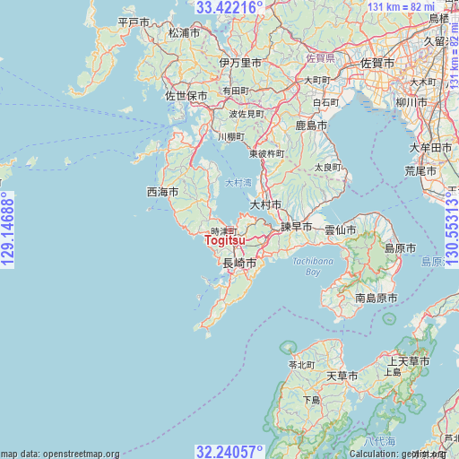
Togitsu GPS coordinates[2]
32° 49' 59.988" North, 129° 51' 0" East
| Map corner | latitude | longitude |
|---|---|---|
| Upper-left | 33.42216°, | 129.14688° |
| Center: | 32.83333°, | 129.85° |
| Lower-right: | 32.24057°, | 130.55313° |
| Map W x H: | 131.4×131.4 km | = 81.6×81.6mi |
| max Lat: | 45.40944° ⇑92.2% North |
| Togitsu: | 32.83333° |
| min Lat: | ⇓7.8% South 24.34478° |
| min Long | Togitsu | max Long |
| 123° | 129.85° | 145.575° |
| W 2.5%⇐ | ⇒97.5% E |
Elevation
Elevation of Togitsu is 1 m = 3 ft, and this is 83.6 m = 274 ft below average elevation for this country.
| Max E: |
1086 m = 3563 ft | 97.9% |
| Avg. | 84.6 m = 278 ft | |
| Togitsu | 1 m = 3 ft | |
Min E: |
-2 m = -7 ft | 2.1% |
See also: Japan elevation on elevation.city.
Geographical zone
Togitsu is located in North temperate zone (between Tropic of Cancer and the Arctic Circle). Distance of this Northern Tropic circle is 1044.8 km =649.2 mi to South.| Distance of | km | miles | from Togitsu |
|---|---|---|---|
| North Pole | 6356.3 | 3949.6 | to North |
| Arctic Circle | 3750.5 | 2330.5 | to North |
| Tropic Cancer | 1044.8 | 649.2 | to South |
| Equator | 3650.7 | 2268.4 | to South |


Nearby cities:
15 places around Togitsu: (largest is in red/bold)
• Imarichō-kō
49 km =30.4 mi,  3°
3°
• Isahaya
18.1 km =11.2 mi,  87°
87°
• Kashima
37.7 km =23.4 mi,  36°
36°
• Minamishimabara
42.9 km =26.7 mi,  114°
114°
• Nagasaki
9.8 km =6.1 mi,  161°
161°
• Obita
3.6 km =2.2 mi,  120°
120°
• Saikai
23 km =14.3 mi,  316°
316°
• Sasebo
39 km =24.2 mi,  342°
342°
• Shimabara
48.6 km =30.2 mi,  96°
96°
• Takeo
42.7 km =26.5 mi,  20°
20°
• Takeochō-takeo
42.7 km =26.5 mi, 21°
• Unzen
37.9 km =23.5 mi, 100°
• Ureshino
38.7 km =24 mi,  29°
29°
• Ureshinomachi-shimojuku
34.3 km =21.3 mi, 24°
• Ōmura
13.8 km =8.6 mi, 44°
Sources, notices
• [Note1] Compared only with cities in Japan existing in our database
• [Src1] Map data: © OpenStreetMap contributors (CC-BY-SA)
• [Src2] Other city data from geonames.org with taken over terms of usage.
• [Src3] Geographical zone / Annual Mean Temperature by Robert A. Rohde @ Wikipedia
