Tōkamachi geodata
Tōkamachi (Niigata) is a seat of a second-order administrative division; located in Japan in Asia/Tokyo (GMT+9) time zone. With population of 41,136 people, there are 441 cities with bigger population in this country. Compared to other cities in Japan, 82.8% of cities are located further ↓South; 57.8% of cities are located further ←West and 83.3% of cities have lower elevation than Tōkamachi. Note1


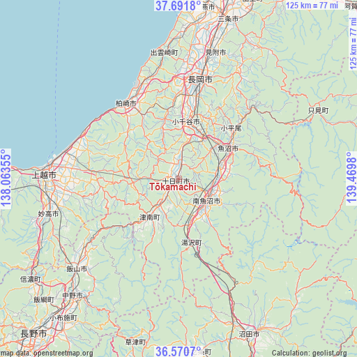
Tōkamachi GPS coordinates[2]
37° 7' 59.988" North, 138° 46' 0.012" East
| Map corner | latitude | longitude |
|---|---|---|
| Upper-left | 37.6918°, | 138.06355° |
| Center: | 37.13333°, | 138.76667° |
| Lower-right: | 36.5707°, | 139.4698° |
| Map W x H: | 124.7×124.7 km | = 77.5×77.5mi |
| max Lat: | 45.40944° ⇑17.2% North |
| Tōkamachi: | 37.13333° |
| min Lat: | ⇓82.8% South 24.34478° |
| min Long | Tōkamachi | max Long |
| 123° | 138.76667° | 145.575° |
| W 57.8%⇐ | ⇒42.2% E |
Elevation
Elevation of Tōkamachi is 154 m = 505 ft, and this is 69.4 m = 228 ft above average elevation for this country.
| Max E: |
1086 m = 3563 ft | 16.7% |
| Tōkamachi | 154 m 505 ft | |
| Avg. | 84.6 m = 278 ft | |
Min E: |
-2 m = -7 ft | 83.3% |
See also: Tōkamachi elevation on elevation.city.
Geographical zone
Tōkamachi is located in North temperate zone (between Tropic of Cancer and the Arctic Circle). Distance of this Northern Tropic circle is 1522.9 km =946.3 mi to South.| Distance of | km | miles | from Tōkamachi |
|---|---|---|---|
| North Pole | 5878.2 | 3652.5 | to North |
| Arctic Circle | 3272.3 | 2033.3 | to North |
| Tropic Cancer | 1522.9 | 946.3 | to South |
| Equator | 4128.8 | 2565.5 | to South |


Nearby cities:
15 places around Tōkamachi: (largest is in red/bold)
• Arai
50.2 km =31.2 mi,  252°
252°
• Iiyama
47.5 km =29.5 mi,  228°
228°
• Jōetsu
47 km =29.2 mi,  272°
272°
• Kashiwazaki
32.3 km =20.1 mi,  323°
323°
• Minamiuonuma
11.1 km =6.9 mi,  120°
120°
• Mitsuke
46.9 km =29.1 mi,  18°
18°
• Muikamachi
12.7 km =7.9 mi,  125°
125°
• Myoko
45.7 km =28.4 mi, 253°
• Nagaoka
36 km =22.4 mi,  11°
11°
• Nakano
55.5 km =34.5 mi,  219°
219°
• Ojiya
18.8 km =11.7 mi, 9°
• Sanjō
56.1 km =34.9 mi, 16°
• Shiozawa
12.9 km =8 mi,  145°
145°
• Tochio-honchō
43.2 km =26.8 mi,  27°
27°
• Uonuma
21.3 km =13.2 mi,  54°
54°
Sources, notices
• [Note1] Compared only with cities in Japan existing in our database
• [Src1] Map data: © OpenStreetMap contributors (CC-BY-SA)
• [Src2] Other city data from geonames.org with taken over terms of usage.
• [Src3] Geographical zone / Annual Mean Temperature by Robert A. Rohde @ Wikipedia
