Tanabe geodata
Tanabe (Wakayama) is a seat of a second-order administrative division; located in Japan in Asia/Tokyo (GMT+9) time zone. With population of 69,563 people, there are 278 cities with bigger population in this country. Compared to other cities in Japan, 82.8% of cities are located further ↑North; 68.2% of cities are located further →East and 81.8% of cities have higher elevation than Tanabe. Note1


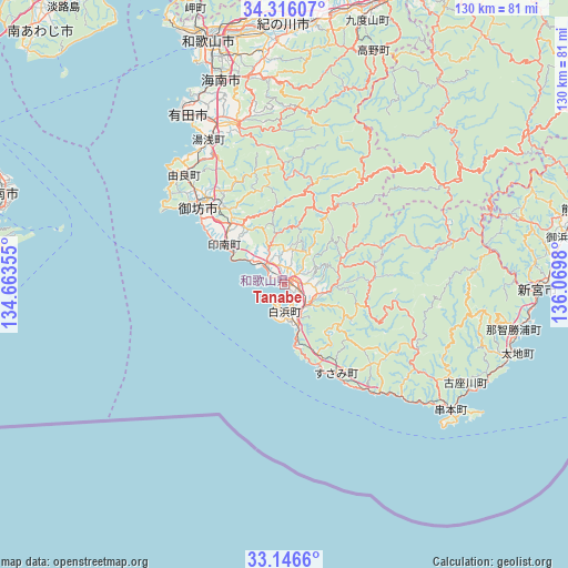
Tanabe GPS coordinates[2]
33° 43' 59.988" North, 135° 22' 0.012" East
| Map corner | latitude | longitude |
|---|---|---|
| Upper-left | 34.31607°, | 134.66355° |
| Center: | 33.73333°, | 135.36667° |
| Lower-right: | 33.1466°, | 136.0698° |
| Map W x H: | 130×130 km | = 80.8×80.8mi |
| max Lat: | 45.40944° ⇑82.8% North |
| Tanabe: | 33.73333° |
| min Lat: | ⇓17.2% South 24.34478° |
| min Long | Tanabe | max Long |
| 123° | 135.36667° | 145.575° |
| W 31.8%⇐ | ⇒68.2% E |
Elevation
Elevation of Tanabe is 7 m = 23 ft, and this is 77.6 m = 255 ft below average elevation for this country.
| Max E: |
1086 m = 3563 ft | 81.8% |
| Avg. | 84.6 m = 278 ft | |
| Tanabe | 7 m = 23 ft | |
Min E: |
-2 m = -7 ft | 18.2% |
See also: Tanabe elevation on elevation.city.
Geographical zone
Tanabe is located in North temperate zone (between Tropic of Cancer and the Arctic Circle). Distance of this Northern Tropic circle is 1144.9 km =711.4 mi to South.| Distance of | km | miles | from Tanabe |
|---|---|---|---|
| North Pole | 6256.3 | 3887.5 | to North |
| Arctic Circle | 3650.4 | 2268.3 | to North |
| Tropic Cancer | 1144.9 | 711.4 | to South |
| Equator | 3750.8 | 2330.6 | to South |


Nearby cities:
15 places around Tanabe: (largest is in red/bold)
• Anan
69.3 km =43.1 mi,  287°
287°
• Arida
44.9 km =27.9 mi,  329°
329°
• Gobō
24.6 km =15.3 mi,  312°
312°
• Hannan
67.6 km =42 mi,  350°
350°
• Hashimoto
68.8 km =42.8 mi,  19°
19°
• Iwade
57.6 km =35.8 mi,  355°
355°
• Izumisano
71.9 km =44.7 mi, 356°
• Kainan
48.6 km =30.2 mi,  343°
343°
• Kinokawa
59.8 km =37.2 mi,  3°
3°
• Kumano
72.3 km =44.9 mi,  74°
74°
• Kōya
58.3 km =36.2 mi, 23°
• Minato
57.2 km =35.5 mi, 339°
• Sennan
69 km =42.9 mi, 352°
• Shingū
57 km =35.4 mi,  90°
90°
• Wakayama
58.6 km =36.4 mi, 341°
Sources, notices
• [Note1] Compared only with cities in Japan existing in our database
• [Src1] Map data: © OpenStreetMap contributors (CC-BY-SA)
• [Src2] Other city data from geonames.org with taken over terms of usage.
• [Src3] Geographical zone / Annual Mean Temperature by Robert A. Rohde @ Wikipedia
