Kumano geodata
Kumano (Mie) is a seat of a second-order administrative division; located in Japan in Asia/Tokyo (GMT+9) time zone. In our database, there are 767 cities with bigger population. Compared to other cities in Japan, 81.4% of cities are located further ↑North; 60.9% of cities are located further →East and 81.8% of cities have lower elevation than Kumano. Note1


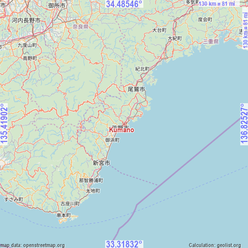
Kumano GPS coordinates[2]
33° 54' 14.004" North, 136° 7' 19.704" East
| Map corner | latitude | longitude |
|---|---|---|
| Upper-left | 34.48546°, | 135.41902° |
| Center: | 33.90389°, | 136.12214° |
| Lower-right: | 33.31832°, | 136.82527° |
| Map W x H: | 129.8×129.8 km | = 80.7×80.7mi |
| max Lat: | 45.40944° ⇑81.4% North |
| Kumano: | 33.90389° |
| min Lat: | ⇓18.6% South 24.34478° |
| min Long | Kumano | max Long |
| 123° | 136.12214° | 145.575° |
| W 39.1%⇐ | ⇒60.9% E |
Elevation
Elevation of Kumano is 138 m = 453 ft, and this is 53.4 m = 175 ft above average elevation for this country.
| Max E: |
1086 m = 3563 ft | 18.2% |
| Kumano | 138 m 453 ft | |
| Avg. | 84.6 m = 278 ft | |
Min E: |
-2 m = -7 ft | 81.8% |
See also: Japan elevation on elevation.city.
Geographical zone
Kumano is located in North temperate zone (between Tropic of Cancer and the Arctic Circle). Distance of this Northern Tropic circle is 1163.8 km =723.2 mi to South.| Distance of | km | miles | from Kumano |
|---|---|---|---|
| North Pole | 6237.3 | 3875.7 | to North |
| Arctic Circle | 3631.4 | 2256.4 | to North |
| Tropic Cancer | 1163.8 | 723.2 | to South |
| Equator | 3769.8 | 2342.4 | to South |


Nearby cities:
15 places around Kumano: (largest is in red/bold)
• Gojō
63 km =39.1 mi,  321°
321°
• Gose
70.5 km =43.8 mi,  329°
329°
• Haibara-akanedai
71.8 km =44.6 mi,  347°
347°
• Hashimoto
65.4 km =40.6 mi,  314°
314°
• Kashihara-shi
73.8 km =45.9 mi,  335°
335°
• Katsuragi
75.6 km =47 mi, 328°
• Kihoku
39.3 km =24.4 mi,  29°
29°
• Kōya
57.4 km =35.7 mi, 306°
• Minamiise
72.7 km =45.2 mi,  46°
46°
• Owase
19.5 km =12.1 mi,  21°
21°
• Sakurai
70.8 km =44 mi, 339°
• Shingū
22.9 km =14.2 mi,  214°
214°
• Tanabe
72.3 km =44.9 mi,  254°
254°
• Yoshino-chō
59.9 km =37.2 mi, 336°
• Ōuda
64.9 km =40.3 mi, 344°
Sources, notices
• [Note1] Compared only with cities in Japan existing in our database
• [Src1] Map data: © OpenStreetMap contributors (CC-BY-SA)
• [Src2] Other city data from geonames.org with taken over terms of usage.
• [Src3] Geographical zone / Annual Mean Temperature by Robert A. Rohde @ Wikipedia
