Takahashi geodata
Takahashi (Okayama) is a seat of a second-order administrative division; located in Japan in Asia/Tokyo (GMT+9) time zone. With population of 24,819 people, there are 616 cities with bigger population in this country. Compared to other cities in Japan, 65.4% of cities are located further ↑North; 76.9% of cities are located further →East and 68% of cities have lower elevation than Takahashi. Note1


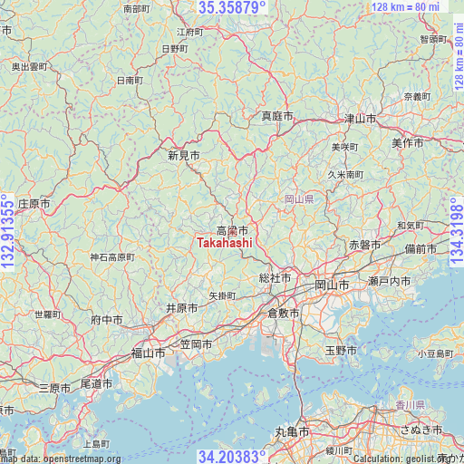
Takahashi GPS coordinates[2]
34° 46' 59.988" North, 133° 37' 0.012" East
| Map corner | latitude | longitude |
|---|---|---|
| Upper-left | 35.35879°, | 132.91355° |
| Center: | 34.78333°, | 133.61667° |
| Lower-right: | 34.20383°, | 134.3198° |
| Map W x H: | 128.4×128.4 km | = 79.8×79.8mi |
| max Lat: | 45.40944° ⇑65.4% North |
| Takahashi: | 34.78333° |
| min Lat: | ⇓34.6% South 24.34478° |
| min Long | Takahashi | max Long |
| 123° | 133.61667° | 145.575° |
| W 23.1%⇐ | ⇒76.9% E |
Elevation
Elevation of Takahashi is 66 m = 217 ft, and this is 18.6 m = 61 ft below average elevation for this country.
| Max E: |
1086 m = 3563 ft | 32% |
| Avg. | 84.6 m = 278 ft | |
| Takahashi | 66 m = 217 ft | |
Min E: |
-2 m = -7 ft | 68% |
See also: Japan elevation on elevation.city.
Geographical zone
Takahashi is located in North temperate zone (between Tropic of Cancer and the Arctic Circle). Distance of this Northern Tropic circle is 1261.6 km =783.9 mi to South.| Distance of | km | miles | from Takahashi |
|---|---|---|---|
| North Pole | 6139.5 | 3814.9 | to North |
| Arctic Circle | 3533.6 | 2195.7 | to North |
| Tropic Cancer | 1261.6 | 783.9 | to South |
| Equator | 3867.5 | 2403.2 | to South |


Nearby cities:
15 places around Takahashi: (largest is in red/bold)
• Akaiwa
37.1 km =23.1 mi,  85°
85°
• Asakuchi
27.7 km =17.2 mi,  182°
182°
• Fuchūchō
42 km =26.1 mi,  236°
236°
• Fukuyama
40.4 km =25.1 mi,  214°
214°
• Ibara
24.6 km =15.3 mi, 213°
• Kamogatachō-kamogata
27.5 km =17.1 mi,  185°
185°
• Kannabechō-yahiro
30.9 km =19.2 mi,  215°
215°
• Kasaoka
32.5 km =20.2 mi,  198°
198°
• Kurashiki
26.1 km =16.2 mi,  148°
148°
• Maniwa
37.1 km =23.1 mi,  14°
14°
• Niimi
26.1 km =16.2 mi,  328°
328°
• Okayama
32.5 km =20.2 mi,  117°
117°
• Shin’ichi
40.4 km =25.1 mi,  231°
231°
• Sōja
17.2 km =10.7 mi,  134°
134°
• Tamano
42.2 km =26.2 mi, 134°
Sources, notices
• [Note1] Compared only with cities in Japan existing in our database
• [Src1] Map data: © OpenStreetMap contributors (CC-BY-SA)
• [Src2] Other city data from geonames.org with taken over terms of usage.
• [Src3] Geographical zone / Annual Mean Temperature by Robert A. Rohde @ Wikipedia
