Shimonoseki geodata
Shimonoseki (Yamaguchi) is a populated place; located in Japan in Asia/Tokyo (GMT+9) time zone. With population of 245,786 people, there are 83 cities with bigger population in this country. Compared to other cities in Japan, 80.9% of cities are located further ↑North; 87.6% of cities are located further →East and 69.3% of cities have higher elevation than Shimonoseki. Note1


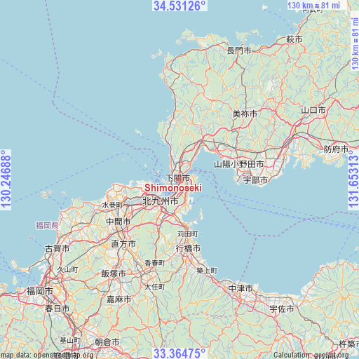
Shimonoseki GPS coordinates[2]
33° 57' 0" North, 130° 57' 0" East
| Map corner | latitude | longitude |
|---|---|---|
| Upper-left | 34.53126°, | 130.24688° |
| Center: | 33.95°, | 130.95° |
| Lower-right: | 33.36475°, | 131.65313° |
| Map W x H: | 129.7×129.7 km | = 80.6×80.6mi |
| max Lat: | 45.40944° ⇑80.9% North |
| Shimonoseki: | 33.95° |
| min Lat: | ⇓19.1% South 24.34478° |
| min Long | Shimonoseki | max Long |
| 123° | 130.95° | 145.575° |
| W 12.4%⇐ | ⇒87.6% E |
Elevation
Elevation of Shimonoseki is 12 m = 39 ft, and this is 72.6 m = 238 ft below average elevation for this country.
| Max E: |
1086 m = 3563 ft | 69.3% |
| Avg. | 84.6 m = 278 ft | |
| Shimonoseki | 12 m = 39 ft | |
Min E: |
-2 m = -7 ft | 30.7% |
See also: Shimonoseki elevation on elevation.city.
Geographical zone
Shimonoseki is located in North temperate zone (between Tropic of Cancer and the Arctic Circle). Distance of this Northern Tropic circle is 1169 km =726.4 mi to South.| Distance of | km | miles | from Shimonoseki |
|---|---|---|---|
| North Pole | 6232.2 | 3872.5 | to North |
| Arctic Circle | 3626.3 | 2253.3 | to North |
| Tropic Cancer | 1169 | 726.4 | to South |
| Equator | 3774.9 | 2345.6 | to South |


Nearby cities:
15 places around Shimonoseki: (largest is in red/bold)
• Kanda
18.8 km =11.7 mi,  170°
170°
• Kitakyushu
14.3 km =8.9 mi,  220°
220°
• Mine
36 km =22.4 mi,  42°
42°
• Miyata
38.4 km =23.9 mi,  225°
225°
• Miyawaka
38.5 km =23.9 mi, 227°
• Nakama
26.7 km =16.6 mi,  236°
236°
• Nōgata
31.4 km =19.5 mi, 222°
• Onoda
22.3 km =13.9 mi,  75°
75°
• Sanyōonoda
21.4 km =13.3 mi,  64°
64°
• Shiida
34.5 km =21.4 mi,  163°
163°
• Shimonoseki
24.6 km =15.3 mi,  10°
10°
• Tagawa
37.8 km =23.5 mi,  201°
201°
• Tsuiki
31.8 km =19.8 mi, 165°
• Ube
27.8 km =17.3 mi,  91°
91°
• Yukuhashi
24.8 km =15.4 mi, 172°
Sources, notices
• [Note1] Compared only with cities in Japan existing in our database
• [Src1] Map data: © OpenStreetMap contributors (CC-BY-SA)
• [Src2] Other city data from geonames.org with taken over terms of usage.
• [Src3] Geographical zone / Annual Mean Temperature by Robert A. Rohde @ Wikipedia
