Matsubase geodata
Matsubase (Kumamoto) is a populated place; located in Japan in Asia/Tokyo (GMT+9) time zone. With population of 26,163 people, there are 592 cities with bigger population in this country. Compared to other cities in Japan, 93.2% of cities are located further ↑North; 90.2% of cities are located further →East and 93.5% of cities have higher elevation than Matsubase. Note1


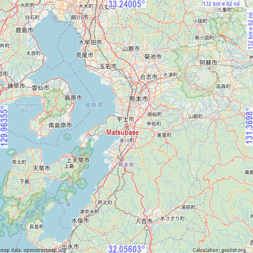
Matsubase GPS coordinates[2]
32° 39' 0" North, 130° 40' 0.012" East
| Map corner | latitude | longitude |
|---|---|---|
| Upper-left | 33.24005°, | 129.96355° |
| Center: | 32.65°, | 130.66667° |
| Lower-right: | 32.05603°, | 131.3698° |
| Map W x H: | 131.7×131.7 km | = 81.8×81.8mi |
| max Lat: | 45.40944° ⇑93.2% North |
| Matsubase: | 32.65° |
| min Lat: | ⇓6.8% South 24.34478° |
| min Long | Matsubase | max Long |
| 123° | 130.66667° | 145.575° |
| W 9.8%⇐ | ⇒90.2% E |
Elevation
Elevation of Matsubase is 4 m = 13 ft, and this is 80.6 m = 264 ft below average elevation for this country.
| Max E: |
1086 m = 3563 ft | 93.5% |
| Avg. | 84.6 m = 278 ft | |
| Matsubase | 4 m = 13 ft | |
Min E: |
-2 m = -7 ft | 6.5% |
See also: Japan elevation on elevation.city.
Geographical zone
Matsubase is located in North temperate zone (between Tropic of Cancer and the Arctic Circle). Distance of this Northern Tropic circle is 1024.4 km =636.5 mi to South.| Distance of | km | miles | from Matsubase |
|---|---|---|---|
| North Pole | 6376.7 | 3962.3 | to North |
| Arctic Circle | 3770.8 | 2343.1 | to North |
| Tropic Cancer | 1024.4 | 636.5 | to South |
| Equator | 3630.3 | 2255.8 | to South |


Nearby cities:
15 places around Matsubase: (largest is in red/bold)
• Honmachi
17.4 km =10.8 mi,  201°
201°
• Kamiamakusa
31.2 km =19.4 mi,  234°
234°
• Kikuchi
39.6 km =24.6 mi,  20°
20°
• Kumamoto
17.5 km =10.9 mi,  7°
7°
• Kōshi
28.8 km =17.9 mi, 20°
• Minamishimabara
37.5 km =23.3 mi,  273°
273°
• Shimabara
31.7 km =19.7 mi,  297°
297°
• Tamana
34.1 km =21.2 mi,  345°
345°
• Uekimachi-mōno
27.8 km =17.3 mi,  4°
4°
• Uki
3.1 km =1.9 mi,  188°
188°
• Unzen
41.4 km =25.7 mi,  288°
288°
• Uto
3.7 km =2.3 mi, 0°
• Yamaga
40.8 km =25.4 mi, 2°
• Yatsushiro
10.4 km =6.5 mi, 187°
• Ōzu
32 km =19.9 mi,  36°
36°
Sources, notices
• [Note1] Compared only with cities in Japan existing in our database
• [Src1] Map data: © OpenStreetMap contributors (CC-BY-SA)
• [Src2] Other city data from geonames.org with taken over terms of usage.
• [Src3] Geographical zone / Annual Mean Temperature by Robert A. Rohde @ Wikipedia
