Shimabara geodata
Shimabara (Nagasaki) is a seat of a second-order administrative division; located in Japan in Asia/Tokyo (GMT+9) time zone. With population of 38,113 people, there are 472 cities with bigger population in this country. Compared to other cities in Japan, 92.6% of cities are located further ↑North; 94.6% of cities are located further →East and 71.1% of cities have higher elevation than Shimabara. Note1


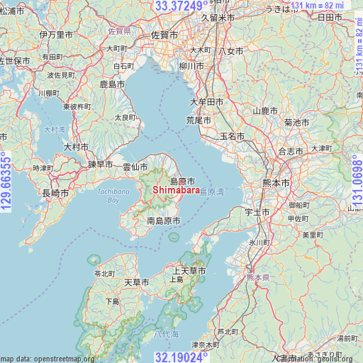
Shimabara GPS coordinates[2]
32° 46' 59.988" North, 130° 22' 0.012" East
| Map corner | latitude | longitude |
|---|---|---|
| Upper-left | 33.37249°, | 129.66355° |
| Center: | 32.78333°, | 130.36667° |
| Lower-right: | 32.19024°, | 131.0698° |
| Map W x H: | 131.5×131.5 km | = 81.7×81.7mi |
| max Lat: | 45.40944° ⇑92.6% North |
| Shimabara: | 32.78333° |
| min Lat: | ⇓7.4% South 24.34478° |
| min Long | Shimabara | max Long |
| 123° | 130.36667° | 145.575° |
| W 5.4%⇐ | ⇒94.6% E |
Elevation
Elevation of Shimabara is 11 m = 36 ft, and this is 73.6 m = 241 ft below average elevation for this country.
| Max E: |
1086 m = 3563 ft | 71.1% |
| Avg. | 84.6 m = 278 ft | |
| Shimabara | 11 m = 36 ft | |
Min E: |
-2 m = -7 ft | 28.9% |
See also: Japan elevation on elevation.city.
Geographical zone
Shimabara is located in North temperate zone (between Tropic of Cancer and the Arctic Circle). Distance of this Northern Tropic circle is 1039.2 km =645.7 mi to South.| Distance of | km | miles | from Shimabara |
|---|---|---|---|
| North Pole | 6361.9 | 3953.1 | to North |
| Arctic Circle | 3756 | 2333.9 | to North |
| Tropic Cancer | 1039.2 | 645.7 | to South |
| Equator | 3645.2 | 2265 | to South |


Nearby cities:
15 places around Shimabara: (largest is in red/bold)
• Arao
23 km =14.3 mi,  18°
18°
• Honmachi
37.9 km =23.5 mi,  144°
144°
• Isahaya
30.9 km =19.2 mi,  281°
281°
• Kamiamakusa
32.8 km =20.4 mi,  175°
175°
• Kumamoto
30.5 km =19 mi,  85°
85°
• Matsubase
31.7 km =19.7 mi,  117°
117°
• Minamishimabara
15.4 km =9.6 mi,  217°
217°
• Miyama
39.6 km =24.6 mi, 18°
• Tamana
26.6 km =16.5 mi,  46°
46°
• Uekimachi-mōno
32.8 km =20.4 mi,  66°
66°
• Uki
32.9 km =20.4 mi, 122°
• Unzen
11.1 km =6.9 mi,  262°
262°
• Uto
30.2 km =18.8 mi,  111°
111°
• Yatsushiro
36.7 km =22.8 mi,  133°
133°
• Ōmuta
28.9 km =18 mi, 15°
Sources, notices
• [Note1] Compared only with cities in Japan existing in our database
• [Src1] Map data: © OpenStreetMap contributors (CC-BY-SA)
• [Src2] Other city data from geonames.org with taken over terms of usage.
• [Src3] Geographical zone / Annual Mean Temperature by Robert A. Rohde @ Wikipedia
