Katsuyama geodata
Katsuyama (Fukui) is a seat of a second-order administrative division; located in Japan in Asia/Tokyo (GMT+9) time zone. With population of 27,088 people, there are 578 cities with bigger population in this country. Compared to other cities in Japan, 68.8% of cities are located further ↓South; 58.4% of cities are located further →East and 81.3% of cities have lower elevation than Katsuyama. Note1


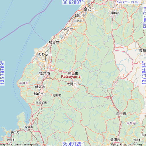
Katsuyama GPS coordinates[2]
36° 3' 42.228" North, 136° 30' 3.636" East
| Map corner | latitude | longitude |
|---|---|---|
| Upper-left | 36.62807°, | 135.79789° |
| Center: | 36.06173°, | 136.50101° |
| Lower-right: | 35.49129°, | 137.20414° |
| Map W x H: | 126.4×126.4 km | = 78.5×78.5mi |
| max Lat: | 45.40944° ⇑31.2% North |
| Katsuyama: | 36.06173° |
| min Lat: | ⇓68.8% South 24.34478° |
| min Long | Katsuyama | max Long |
| 123° | 136.50101° | 145.575° |
| W 41.6%⇐ | ⇒58.4% E |
Elevation
Elevation of Katsuyama is 130 m = 427 ft, and this is 45.4 m = 149 ft above average elevation for this country.
| Max E: |
1086 m = 3563 ft | 18.7% |
| Katsuyama | 130 m 427 ft | |
| Avg. | 84.6 m = 278 ft | |
Min E: |
-2 m = -7 ft | 81.3% |
See also: Japan elevation on elevation.city.
Geographical zone
Katsuyama is located in North temperate zone (between Tropic of Cancer and the Arctic Circle). Distance of this Northern Tropic circle is 1403.8 km =872.3 mi to South.| Distance of | km | miles | from Katsuyama |
|---|---|---|---|
| North Pole | 5997.4 | 3726.6 | to North |
| Arctic Circle | 3391.5 | 2107.4 | to North |
| Tropic Cancer | 1403.8 | 872.3 | to South |
| Equator | 4009.7 | 2491.5 | to South |


Nearby cities:
15 places around Katsuyama: (largest is in red/bold)
• Asahi
35.3 km =21.9 mi,  253°
253°
• Awara
33 km =20.5 mi,  302°
302°
• Echizen
35.6 km =22.1 mi,  236°
236°
• Fukui-shi
25 km =15.5 mi,  270°
270°
• Kaga
30.5 km =19 mi,  330°
330°
• Komatsu
38.2 km =23.7 mi,  353°
353°
• Maruoka
23.1 km =14.4 mi, 296°
• Mikuni
35.8 km =22.2 mi, 298°
• Motosu
46.2 km =28.7 mi,  167°
167°
• Nomi
41 km =25.5 mi,  5°
5°
• Ono
9.1 km =5.7 mi,  187°
187°
• Sabae
31.2 km =19.4 mi, 245°
• Sakai
29.2 km =18.1 mi,  289°
289°
• Takefu
34.8 km =21.6 mi, 239°
• Tsurugi-asahimachi
44.8 km =27.8 mi,  15°
15°
Sources, notices
• [Note1] Compared only with cities in Japan existing in our database
• [Src1] Map data: © OpenStreetMap contributors (CC-BY-SA)
• [Src2] Other city data from geonames.org with taken over terms of usage.
• [Src3] Geographical zone / Annual Mean Temperature by Robert A. Rohde @ Wikipedia
