Kashihara geodata
Kashihara (Ōsaka) is a seat of a second-order administrative division; located in Japan in Asia/Tokyo (GMT+9) time zone. With population of 79,058 people, there are 255 cities with bigger population in this country. Compared to other cities in Japan, 70.7% of cities are located further ↑North; 65.4% of cities are located further →East and 61.1% of cities have higher elevation than Kashihara. Note1


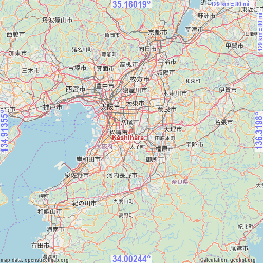
Kashihara GPS coordinates[2]
34° 34' 59.988" North, 135° 37' 0.012" East
| Map corner | latitude | longitude |
|---|---|---|
| Upper-left | 35.16019°, | 134.91355° |
| Center: | 34.58333°, | 135.61667° |
| Lower-right: | 34.00244°, | 136.3198° |
| Map W x H: | 128.7×128.7 km | = 80×80mi |
| max Lat: | 45.40944° ⇑70.7% North |
| Kashihara: | 34.58333° |
| min Lat: | ⇓29.3% South 24.34478° |
| min Long | Kashihara | max Long |
| 123° | 135.61667° | 145.575° |
| W 34.6%⇐ | ⇒65.4% E |
Elevation
Elevation of Kashihara is 18 m = 59 ft, and this is 66.6 m = 219 ft below average elevation for this country.
| Max E: |
1086 m = 3563 ft | 61.1% |
| Avg. | 84.6 m = 278 ft | |
| Kashihara | 18 m = 59 ft | |
Min E: |
-2 m = -7 ft | 38.9% |
See also: Kashihara elevation on elevation.city.
Geographical zone
Kashihara is located in North temperate zone (between Tropic of Cancer and the Arctic Circle). Distance of this Northern Tropic circle is 1239.4 km =770.1 mi to South.| Distance of | km | miles | from Kashihara |
|---|---|---|---|
| North Pole | 6161.8 | 3828.8 | to North |
| Arctic Circle | 3555.9 | 2209.5 | to North |
| Tropic Cancer | 1239.4 | 770.1 | to South |
| Equator | 3845.3 | 2389.4 | to South |


Nearby cities:
15 places around Kashihara: (largest is in red/bold)
• Daitōchō
14.5 km =9 mi,  1°
1°
• Fujiidera
2.5 km =1.6 mi,  225°
225°
• Habikino
4.1 km =2.5 mi,  214°
214°
• Higashi-ōsaka
9.8 km =6.1 mi,  341°
341°
• Hōryūji
11.5 km =7.1 mi,  73°
73°
• Ikoma
13.5 km =8.4 mi,  34°
34°
• Kashiba
10.1 km =6.3 mi,  122°
122°
• Katsuragi
13.1 km =8.1 mi,  145°
145°
• Matsubara
6.4 km =4 mi,  253°
253°
• Sakai
13.7 km =8.5 mi,  270°
270°
• Tondabayashichō
9.3 km =5.8 mi,  188°
188°
• Yamato-Takada
14.3 km =8.9 mi, 121°
• Yamatokōriyama
14.3 km =8.9 mi,  79°
79°
• Yao
4 km =2.5 mi, 337°
• Ōsaka-sayama
11.5 km =7.1 mi, 211°
Sources, notices
• [Note1] Compared only with cities in Japan existing in our database
• [Src1] Map data: © OpenStreetMap contributors (CC-BY-SA)
• [Src2] Other city data from geonames.org with taken over terms of usage.
• [Src3] Geographical zone / Annual Mean Temperature by Robert A. Rohde @ Wikipedia
