Hita geodata
Hita (Oita) is a seat of a second-order administrative division; located in Japan in Asia/Tokyo (GMT+9) time zone. With population of 61,481 people, there are 318 cities with bigger population in this country. Compared to other cities in Japan, 87.6% of cities are located further ↑North; 87.7% of cities are located further →East and 73.5% of cities have lower elevation than Hita. Note1


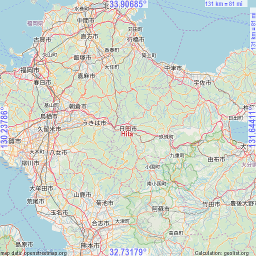
Hita GPS coordinates[2]
33° 19' 16.68" North, 130° 56' 27.528" East
| Map corner | latitude | longitude |
|---|---|---|
| Upper-left | 33.90685°, | 130.23786° |
| Center: | 33.3213°, | 130.94098° |
| Lower-right: | 32.73179°, | 131.64411° |
| Map W x H: | 130.7×130.7 km | = 81.2×81.2mi |
| max Lat: | 45.40944° ⇑87.6% North |
| Hita: | 33.3213° |
| min Lat: | ⇓12.4% South 24.34478° |
| min Long | Hita | max Long |
| 123° | 130.94098° | 145.575° |
| W 12.3%⇐ | ⇒87.7% E |
Elevation
Elevation of Hita is 90 m = 295 ft, and this is 5.4 m = 18 ft above average elevation for this country.
| Max E: |
1086 m = 3563 ft | 26.5% |
| Hita | 90 m 295 ft | |
| Avg. | 84.6 m = 278 ft | |
Min E: |
-2 m = -7 ft | 73.5% |
See also: Hita elevation on elevation.city.
Geographical zone
Hita is located in North temperate zone (between Tropic of Cancer and the Arctic Circle). Distance of this Northern Tropic circle is 1099.1 km =682.9 mi to South.| Distance of | km | miles | from Hita |
|---|---|---|---|
| North Pole | 6302.1 | 3915.9 | to North |
| Arctic Circle | 3696.2 | 2296.7 | to North |
| Tropic Cancer | 1099.1 | 682.9 | to South |
| Equator | 3705 | 2302.2 | to South |


Nearby cities:
15 places around Hita: (largest is in red/bold)
• Amagi
28.7 km =17.8 mi,  291°
291°
• Asakura
23.1 km =14.4 mi,  296°
296°
• Buzen
36.7 km =22.8 mi,  28°
28°
• Kama
30.1 km =18.7 mi,  322°
322°
• Kawasaki
33.1 km =20.6 mi,  339°
339°
• Nakatsu
24.4 km =15.2 mi,  49°
49°
• Nakatsu
38.4 km =23.9 mi,  36°
36°
• Ogōri
37.2 km =23.1 mi,  281°
281°
• Shiida
38.5 km =23.9 mi,  16°
16°
• Tagawa
37.1 km =23.1 mi, 339°
• Tanushimarumachi-toyoki
24.1 km =15 mi, 277°
• Tsukawaki
20.6 km =12.8 mi,  103°
103°
• Ukiha
18.2 km =11.3 mi, 282°
• Yame
29.1 km =18.1 mi,  249°
249°
• Yoshitomi
38.1 km =23.7 mi, 34°
Sources, notices
• [Note1] Compared only with cities in Japan existing in our database
• [Src1] Map data: © OpenStreetMap contributors (CC-BY-SA)
• [Src2] Other city data from geonames.org with taken over terms of usage.
• [Src3] Geographical zone / Annual Mean Temperature by Robert A. Rohde @ Wikipedia
