Iwaki geodata
Iwaki (Fukushima) is a seat of a second-order administrative division; located in Japan in Asia/Tokyo (GMT+9) time zone. With population of 357,309 people, there are 47 cities with bigger population in this country. Compared to other cities in Japan, 82.4% of cities are located further ↓South; 91.7% of cities are located further ←West and 76.3% of cities have higher elevation than Iwaki. Note1


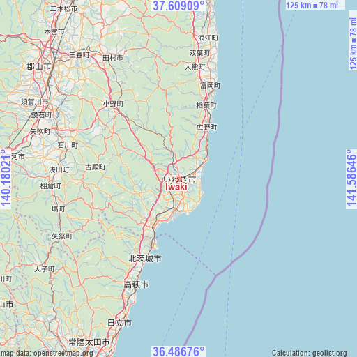
Iwaki GPS coordinates[2]
37° 3' 0" North, 140° 52' 59.988" East
| Map corner | latitude | longitude |
|---|---|---|
| Upper-left | 37.60909°, | 140.18021° |
| Center: | 37.05°, | 140.88333° |
| Lower-right: | 36.48676°, | 141.58646° |
| Map W x H: | 124.8×124.8 km | = 77.5×77.5mi |
| max Lat: | 45.40944° ⇑17.6% North |
| Iwaki: | 37.05° |
| min Lat: | ⇓82.4% South 24.34478° |
| min Long | Iwaki | max Long |
| 123° | 140.88333° | 145.575° |
| W 91.7%⇐ | ⇒8.3% E |
Elevation
Elevation of Iwaki is 9 m = 30 ft, and this is 75.6 m = 248 ft below average elevation for this country.
| Max E: |
1086 m = 3563 ft | 76.3% |
| Avg. | 84.6 m = 278 ft | |
| Iwaki | 9 m = 30 ft | |
Min E: |
-2 m = -7 ft | 23.7% |
See also: Iwaki elevation on elevation.city.
Geographical zone
Iwaki is located in North temperate zone (between Tropic of Cancer and the Arctic Circle). Distance of this Northern Tropic circle is 1513.7 km =940.6 mi to South.| Distance of | km | miles | from Iwaki |
|---|---|---|---|
| North Pole | 5887.5 | 3658.3 | to North |
| Arctic Circle | 3281.6 | 2039.1 | to North |
| Tropic Cancer | 1513.7 | 940.6 | to South |
| Equator | 4119.6 | 2559.8 | to South |


Nearby cities:
15 places around Iwaki: (largest is in red/bold)
• Daigo
56.9 km =35.4 mi,  236°
236°
• Funehikimachi-funehiki
51.8 km =32.2 mi,  328°
328°
• Hitachi
54.2 km =33.7 mi,  202°
202°
• Hitachi-ota
63.8 km =39.6 mi,  209°
209°
• Ishikawa
40 km =24.9 mi,  286°
286°
• Kitaibaraki
31.6 km =19.6 mi, 202°
• Kōriyama
58.9 km =36.6 mi,  311°
311°
• Miharu
55.4 km =34.4 mi,  320°
320°
• Minami-Sōma
64.9 km =40.3 mi,  7°
7°
• Motomiya
67 km =41.6 mi, 320°
• Namie
49.3 km =30.6 mi, 12°
• Shirakawa
55.6 km =34.5 mi,  277°
277°
• Sukagawa
51.3 km =31.9 mi,  300°
300°
• Takahagi
39.9 km =24.8 mi, 201°
• Tamura
49 km =30.4 mi, 329°
Sources, notices
• [Note1] Compared only with cities in Japan existing in our database
• [Src1] Map data: © OpenStreetMap contributors (CC-BY-SA)
• [Src2] Other city data from geonames.org with taken over terms of usage.
• [Src3] Geographical zone / Annual Mean Temperature by Robert A. Rohde @ Wikipedia
