Ichinoseki geodata
Ichinoseki (Iwate) is a seat of a second-order administrative division; located in Japan in Asia/Tokyo (GMT+9) time zone. With population of 62,970 people, there are 310 cities with bigger population in this country. Compared to other cities in Japan, 90.5% of cities are located further ↓South; 93.6% of cities are located further ←West and 51.7% of cities have lower elevation than Ichinoseki. Note1


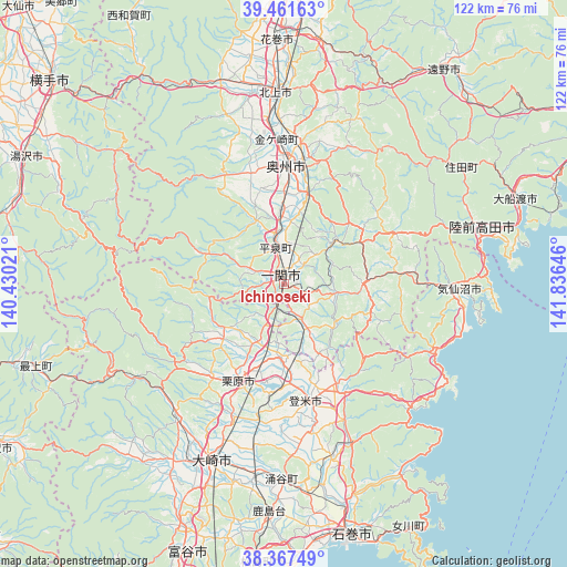
Ichinoseki GPS coordinates[2]
38° 55' 0.012" North, 141° 7' 59.988" East
| Map corner | latitude | longitude |
|---|---|---|
| Upper-left | 39.46163°, | 140.43021° |
| Center: | 38.91667°, | 141.13333° |
| Lower-right: | 38.36749°, | 141.83646° |
| Map W x H: | 121.7×121.7 km | = 75.6×75.6mi |
| max Lat: | 45.40944° ⇑9.5% North |
| Ichinoseki: | 38.91667° |
| min Lat: | ⇓90.5% South 24.34478° |
| min Long | Ichinoseki | max Long |
| 123° | 141.13333° | 145.575° |
| W 93.6%⇐ | ⇒6.4% E |
Elevation
Elevation of Ichinoseki is 30 m = 98 ft, and this is 54.6 m = 179 ft below average elevation for this country.
| Max E: |
1086 m = 3563 ft | 48.3% |
| Avg. | 84.6 m = 278 ft | |
| Ichinoseki | 30 m = 98 ft | |
Min E: |
-2 m = -7 ft | 51.7% |
See also: Ichinoseki elevation on elevation.city.
Geographical zone
Ichinoseki is located in North temperate zone (between Tropic of Cancer and the Arctic Circle). Distance of this Northern Tropic circle is 1721.2 km =1069.5 mi to South.| Distance of | km | miles | from Ichinoseki |
|---|---|---|---|
| North Pole | 5679.9 | 3529.3 | to North |
| Arctic Circle | 3074 | 1910.1 | to North |
| Tropic Cancer | 1721.2 | 1069.5 | to South |
| Equator | 4327.1 | 2688.7 | to South |


Nearby cities:
15 places around Ichinoseki: (largest is in red/bold)
• Furukawa
41.3 km =25.7 mi,  201°
201°
• Hanamaki
51.9 km =32.2 mi,  358°
358°
• Kesennuma
38.5 km =23.9 mi,  92°
92°
• Kitakami
40.8 km =25.4 mi, 357°
• Kogota
41.4 km =25.7 mi,  190°
190°
• Kurihara
21.8 km =13.5 mi,  211°
211°
• Mizusawa
24.1 km =15 mi,  0°
0°
• Rikuzentakata
42.5 km =26.4 mi,  71°
71°
• Tome
23.2 km =14.4 mi,  175°
175°
• Tōno
56.3 km =35 mi,  37°
37°
• Wakuya
41.4 km =25.7 mi, 179°
• Yamoto
54.9 km =34.1 mi,  172°
172°
• Ōfunato
53.3 km =33.1 mi, 71°
• Ōsaki
39 km =24.2 mi, 200°
• Ōshū
24.9 km =15.5 mi,  6°
6°
Sources, notices
• [Note1] Compared only with cities in Japan existing in our database
• [Src1] Map data: © OpenStreetMap contributors (CC-BY-SA)
• [Src2] Other city data from geonames.org with taken over terms of usage.
• [Src3] Geographical zone / Annual Mean Temperature by Robert A. Rohde @ Wikipedia
