Abiko geodata
Abiko (Chiba) is a seat of a second-order administrative division; located in Japan in Asia/Tokyo (GMT+9) time zone. With population of 131,771 people, there are 158 cities with bigger population in this country. Compared to other cities in Japan, 64.1% of cities are located further ↓South; 79% of cities are located further ←West and 73.6% of cities have higher elevation than Abiko. Note1


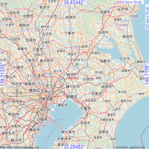
Abiko GPS coordinates[2]
35° 52' 0.012" North, 140° 1' 0.012" East
| Map corner | latitude | longitude |
|---|---|---|
| Upper-left | 36.43442°, | 139.31355° |
| Center: | 35.86667°, | 140.01667° |
| Lower-right: | 35.29483°, | 140.7198° |
| Map W x H: | 126.7×126.7 km | = 78.7×78.7mi |
| max Lat: | 45.40944° ⇑35.9% North |
| Abiko: | 35.86667° |
| min Lat: | ⇓64.1% South 24.34478° |
| min Long | Abiko | max Long |
| 123° | 140.01667° | 145.575° |
| W 79%⇐ | ⇒21% E |
Elevation
Elevation of Abiko is 10 m = 33 ft, and this is 74.6 m = 245 ft below average elevation for this country.
| Max E: |
1086 m = 3563 ft | 73.6% |
| Avg. | 84.6 m = 278 ft | |
| Abiko | 10 m = 33 ft | |
Min E: |
-2 m = -7 ft | 26.4% |
See also: Abiko elevation on elevation.city.
Geographical zone
Abiko is located in North temperate zone (between Tropic of Cancer and the Arctic Circle). Distance of this Northern Tropic circle is 1382.1 km =858.8 mi to South.| Distance of | km | miles | from Abiko |
|---|---|---|---|
| North Pole | 6019.1 | 3740.1 | to North |
| Arctic Circle | 3413.2 | 2120.9 | to North |
| Tropic Cancer | 1382.1 | 858.8 | to South |
| Equator | 3988 | 2478 | to South |


Nearby cities:
15 places around Abiko: (largest is in red/bold)
• Fujishiro
10.6 km =6.6 mi,  58°
58°
• Inzai
13.7 km =8.5 mi,  104°
104°
• Kamagaya
10.9 km =6.8 mi,  186°
186°
• Kashiwa
3.6 km =2.2 mi,  262°
262°
• Matsudo
14.2 km =8.8 mi,  227°
227°
• Misato
12.3 km =7.6 mi, 258°
• Moriya
7.6 km =4.7 mi,  348°
348°
• Nagareyama
10.3 km =6.4 mi, 263°
• Noda
16.2 km =10.1 mi,  304°
304°
• Ryūgasaki
15.5 km =9.6 mi,  76°
76°
• Shiroi
8.7 km =5.4 mi,  148°
148°
• Toride
7.1 km =4.4 mi, 58°
• Tsukubamirai
13.1 km =8.1 mi,  357°
357°
• Ushiku
15.3 km =9.5 mi,  43°
43°
• Yoshikawa
16 km =9.9 mi,  280°
280°
Sources, notices
• [Note1] Compared only with cities in Japan existing in our database
• [Src1] Map data: © OpenStreetMap contributors (CC-BY-SA)
• [Src2] Other city data from geonames.org with taken over terms of usage.
• [Src3] Geographical zone / Annual Mean Temperature by Robert A. Rohde @ Wikipedia
