Yoichi geodata
Yoichi (Hokkaido) is a populated place; located in Japan in Asia/Tokyo (GMT+9) time zone. With population of 22,788 people, there are 645 cities with bigger population in this country. Compared to other cities in Japan, 97.5% of cities are located further ↓South; 90.8% of cities are located further ←West and 96.8% of cities have higher elevation than Yoichi. Note1


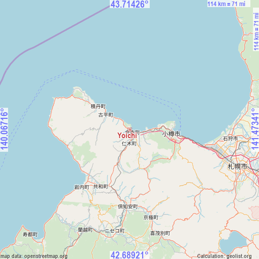
Yoichi GPS coordinates[2]
43° 12' 14.004" North, 140° 46' 13.008" East
| Map corner | latitude | longitude |
|---|---|---|
| Upper-left | 43.71426°, | 140.06716° |
| Center: | 43.20389°, | 140.77028° |
| Lower-right: | 42.68921°, | 141.47341° |
| Map W x H: | 114×114 km | = 70.8×70.8mi |
| max Lat: | 45.40944° ⇑2.5% North |
| Yoichi: | 43.20389° |
| min Lat: | ⇓97.5% South 24.34478° |
| min Long | Yoichi | max Long |
| 123° | 140.77028° | 145.575° |
| W 90.8%⇐ | ⇒9.2% E |
Elevation
Elevation of Yoichi is 2 m = 7 ft, and this is 82.6 m = 271 ft below average elevation for this country.
| Max E: |
1086 m = 3563 ft | 96.8% |
| Avg. | 84.6 m = 278 ft | |
| Yoichi | 2 m = 7 ft | |
Min E: |
-2 m = -7 ft | 3.2% |
See also: Japan elevation on elevation.city.
Geographical zone
Yoichi is located in North temperate zone (between Tropic of Cancer and the Arctic Circle). Distance of this Northern Tropic circle is 2197.9 km =1365.7 mi to South.| Distance of | km | miles | from Yoichi |
|---|---|---|---|
| North Pole | 5203.2 | 3233.1 | to North |
| Arctic Circle | 2597.4 | 1613.9 | to North |
| Tropic Cancer | 2197.9 | 1365.7 | to South |
| Equator | 4803.8 | 2984.9 | to South |


Nearby cities:
15 places around Yoichi: (largest is in red/bold)
• Bibai
89.1 km =55.4 mi,  81°
81°
• Chitose
83.5 km =51.9 mi,  120°
120°
• Date
82.2 km =51.1 mi,  174°
174°
• Ebetsu
64.2 km =39.9 mi,  99°
99°
• Eniwa
74 km =46 mi, 117°
• Ishikari
47.5 km =29.5 mi,  85°
85°
• Iwamizawa
80.2 km =49.8 mi, 90°
• Iwanai
33.2 km =20.6 mi,  219°
219°
• Kitahiroshima
69.5 km =43.2 mi,  111°
111°
• Niseko Town
48 km =29.8 mi,  189°
189°
• Noboribetsu
90 km =55.9 mi,  158°
158°
• Otaru
18.9 km =11.7 mi, 94°
• Sapporo
49.5 km =30.8 mi, 107°
• Shiraoi
86.7 km =53.9 mi,  146°
146°
• Tōbetsu
60.5 km =37.6 mi, 88°
Sources, notices
• [Note1] Compared only with cities in Japan existing in our database
• [Src1] Map data: © OpenStreetMap contributors (CC-BY-SA)
• [Src2] Other city data from geonames.org with taken over terms of usage.
• [Src3] Geographical zone / Annual Mean Temperature by Robert A. Rohde @ Wikipedia
