Fukagawa geodata
Fukagawa (Hokkaido) is a seat of a second-order administrative division; located in Japan in Asia/Tokyo (GMT+9) time zone. With population of 26,152 people, there are 593 cities with bigger population in this country. Compared to other cities in Japan, 98.8% of cities are located further ↓South; 98% of cities are located further ←West and 57.2% of cities have lower elevation than Fukagawa. Note1


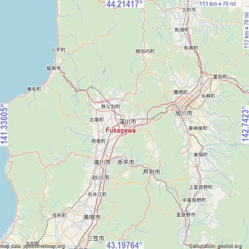
Fukagawa GPS coordinates[2]
43° 42' 29.016" North, 142° 2' 21.012" East
| Map corner | latitude | longitude |
|---|---|---|
| Upper-left | 44.21417°, | 141.33605° |
| Center: | 43.70806°, | 142.03917° |
| Lower-right: | 43.19764°, | 142.7423° |
| Map W x H: | 113×113 km | = 70.2×70.2mi |
| max Lat: | 45.40944° ⇑1.2% North |
| Fukagawa: | 43.70806° |
| min Lat: | ⇓98.8% South 24.34478° |
| min Long | Fukagawa | max Long |
| 123° | 142.03917° | 145.575° |
| W 98%⇐ | ⇒2% E |
Elevation
Elevation of Fukagawa is 40 m = 131 ft, and this is 44.6 m = 146 ft below average elevation for this country.
| Max E: |
1086 m = 3563 ft | 42.8% |
| Avg. | 84.6 m = 278 ft | |
| Fukagawa | 40 m = 131 ft | |
Min E: |
-2 m = -7 ft | 57.2% |
See also: Japan elevation on elevation.city.
Geographical zone
Fukagawa is located in North temperate zone (between Tropic of Cancer and the Arctic Circle). Distance of this Northern Tropic circle is 2254 km =1400.6 mi to South.| Distance of | km | miles | from Fukagawa |
|---|---|---|---|
| North Pole | 5147.2 | 3198.3 | to North |
| Arctic Circle | 2541.3 | 1579.1 | to North |
| Tropic Cancer | 2254 | 1400.6 | to South |
| Equator | 4859.9 | 3019.8 | to South |


Nearby cities:
15 places around Fukagawa: (largest is in red/bold)
• Akabira
17.5 km =10.9 mi,  176°
176°
• Asahikawa
27.1 km =16.8 mi,  75°
75°
• Ashibetsu
25 km =15.5 mi,  151°
151°
• Bibai
45 km =28 mi,  198°
198°
• Furano
48.5 km =30.1 mi, 145°
• Iwamizawa
60.8 km =37.8 mi, 201°
• Kamikawa
60.6 km =37.7 mi, 75°
• Mikasa
51.7 km =32.1 mi,  193°
193°
• Rumoi
40.6 km =25.2 mi,  308°
308°
• Shibetsu
58.9 km =36.6 mi,  28°
28°
• Shimo-furano
48.5 km =30.1 mi, 145°
• Sunagawa
26.9 km =16.7 mi, 203°
• Takikawa
20.3 km =12.6 mi,  211°
211°
• Tōbetsu
69 km =42.9 mi,  217°
217°
• Utashinai
21.3 km =13.2 mi, 177°
Sources, notices
• [Note1] Compared only with cities in Japan existing in our database
• [Src1] Map data: © OpenStreetMap contributors (CC-BY-SA)
• [Src2] Other city data from geonames.org with taken over terms of usage.
• [Src3] Geographical zone / Annual Mean Temperature by Robert A. Rohde @ Wikipedia
