Asahikawa geodata
Asahikawa (Hokkaido) is a seat of a second-order administrative division; located in Japan in Asia/Tokyo (GMT+9) time zone. With population of 356,612 people, there are 48 cities with bigger population in this country. Compared to other cities in Japan, 98.9% of cities are located further ↓South; 98.5% of cities are located further ←West and 79.6% of cities have lower elevation than Asahikawa. Note1


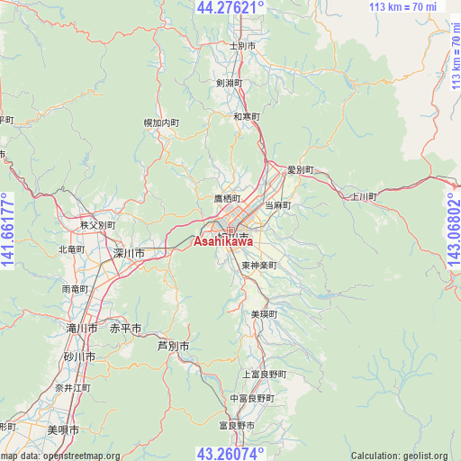
Asahikawa GPS coordinates[2]
43° 46' 14.268" North, 142° 21' 53.604" East
| Map corner | latitude | longitude |
|---|---|---|
| Upper-left | 44.27621°, | 141.66177° |
| Center: | 43.77063°, | 142.36489° |
| Lower-right: | 43.26074°, | 143.06802° |
| Map W x H: | 112.9×112.9 km | = 70.2×70.2mi |
| max Lat: | 45.40944° ⇑1.1% North |
| Asahikawa: | 43.77063° |
| min Lat: | ⇓98.9% South 24.34478° |
| min Long | Asahikawa | max Long |
| 123° | 142.36489° | 145.575° |
| W 98.5%⇐ | ⇒1.5% E |
Elevation
Elevation of Asahikawa is 121 m = 397 ft, and this is 36.4 m = 119 ft above average elevation for this country.
| Max E: |
1086 m = 3563 ft | 20.4% |
| Asahikawa | 121 m 397 ft | |
| Avg. | 84.6 m = 278 ft | |
Min E: |
-2 m = -7 ft | 79.6% |
See also: Asahikawa elevation on elevation.city.
Geographical zone
Asahikawa is located in North temperate zone (between Tropic of Cancer and the Arctic Circle). Distance of this Northern Tropic circle is 2260.9 km =1404.9 mi to South.| Distance of | km | miles | from Asahikawa |
|---|---|---|---|
| North Pole | 5140.2 | 3194 | to North |
| Arctic Circle | 2534.3 | 1574.7 | to North |
| Tropic Cancer | 2260.9 | 1404.9 | to South |
| Equator | 4866.8 | 3024.1 | to South |


Nearby cities:
15 places around Asahikawa: (largest is in red/bold)
• Akabira
35 km =21.7 mi,  225°
225°
• Ashibetsu
32.4 km =20.1 mi,  206°
206°
• Bibai
64.2 km =39.9 mi,  219°
219°
• Fukagawa
27.1 km =16.8 mi,  255°
255°
• Furano
46.8 km =29.1 mi,  178°
178°
• Iwamizawa
80 km =49.7 mi, 217°
• Kamikawa
33.5 km =20.8 mi,  76°
76°
• Mikasa
69 km =42.9 mi, 213°
• Nayoro
64.9 km =40.3 mi,  6°
6°
• Rumoi
60.7 km =37.7 mi,  287°
287°
• Shibetsu
44.6 km =27.7 mi,  3°
3°
• Shimo-furano
46.8 km =29.1 mi, 178°
• Sunagawa
48.6 km =30.2 mi, 229°
• Takikawa
44.1 km =27.4 mi,  236°
236°
• Utashinai
37.9 km =23.5 mi, 221°
Sources, notices
• [Note1] Compared only with cities in Japan existing in our database
• [Src1] Map data: © OpenStreetMap contributors (CC-BY-SA)
• [Src2] Other city data from geonames.org with taken over terms of usage.
• [Src3] Geographical zone / Annual Mean Temperature by Robert A. Rohde @ Wikipedia
