Takashima geodata
Takashima (Shiga) is a seat of a second-order administrative division; located in Japan in Asia/Tokyo (GMT+9) time zone. In our database, there are 767 cities with bigger population. Compared to other cities in Japan, 50.9% of cities are located further ↓South; 61.5% of cities are located further →East and 77.7% of cities have lower elevation than Takashima. Note1


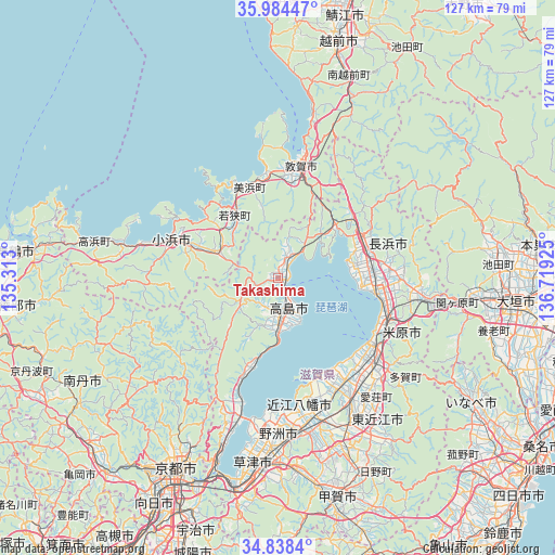
Takashima GPS coordinates[2]
35° 24' 48.492" North, 136° 0' 58.032" East
| Map corner | latitude | longitude |
|---|---|---|
| Upper-left | 35.98447°, | 135.313° |
| Center: | 35.41347°, | 136.01612° |
| Lower-right: | 34.8384°, | 136.71925° |
| Map W x H: | 127.4×127.4 km | = 79.2×79.2mi |
| max Lat: | 45.40944° ⇑49.1% North |
| Takashima: | 35.41347° |
| min Lat: | ⇓50.9% South 24.34478° |
| min Long | Takashima | max Long |
| 123° | 136.01612° | 145.575° |
| W 38.5%⇐ | ⇒61.5% E |
Elevation
Elevation of Takashima is 107 m = 351 ft, and this is 22.4 m = 73 ft above average elevation for this country.
| Max E: |
1086 m = 3563 ft | 22.3% |
| Takashima | 107 m 351 ft | |
| Avg. | 84.6 m = 278 ft | |
Min E: |
-2 m = -7 ft | 77.7% |
See also: Japan elevation on elevation.city.
Geographical zone
Takashima is located in North temperate zone (between Tropic of Cancer and the Arctic Circle). Distance of this Northern Tropic circle is 1331.7 km =827.5 mi to South.| Distance of | km | miles | from Takashima |
|---|---|---|---|
| North Pole | 6069.5 | 3771.4 | to North |
| Arctic Circle | 3463.6 | 2152.2 | to North |
| Tropic Cancer | 1331.7 | 827.5 | to South |
| Equator | 3937.6 | 2446.7 | to South |


Nearby cities:
15 places around Takashima: (largest is in red/bold)
• Higashiōmi
41.1 km =25.5 mi,  146°
146°
• Hikone
27.9 km =17.3 mi,  130°
130°
• Kitahama
28.9 km =18 mi,  198°
198°
• Konan
46.6 km =29 mi,  170°
170°
• Kusatsu
44.3 km =27.5 mi,  185°
185°
• Maibara
26.5 km =16.5 mi,  113°
113°
• Moriyama
38.7 km =24 mi,  184°
184°
• Nagahama
23 km =14.3 mi,  98°
98°
• Obama
26.1 km =16.2 mi,  290°
290°
• Rittō
42.9 km =26.7 mi, 181°
• Tarui
47.2 km =29.3 mi, 96°
• Tsuruga
26 km =16.2 mi,  7°
7°
• Yasu
34.8 km =21.6 mi, 179°
• Youkaichi
36.9 km =22.9 mi, 153°
• Ōmihachiman
32.5 km =20.2 mi, 166°
Sources, notices
• [Note1] Compared only with cities in Japan existing in our database
• [Src1] Map data: © OpenStreetMap contributors (CC-BY-SA)
• [Src2] Other city data from geonames.org with taken over terms of usage.
• [Src3] Geographical zone / Annual Mean Temperature by Robert A. Rohde @ Wikipedia
