Obama geodata
Obama (Fukui) is a seat of a second-order administrative division; located in Japan in Asia/Tokyo (GMT+9) time zone. With population of 32,896 people, there are 516 cities with bigger population in this country. Compared to other cities in Japan, 53.5% of cities are located further ↓South; 63.7% of cities are located further →East and 95.3% of cities have higher elevation than Obama. Note1


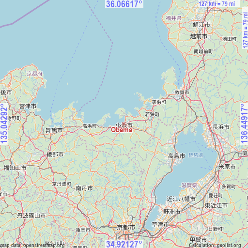
Obama GPS coordinates[2]
35° 29' 44.736" North, 135° 44' 45.744" East
| Map corner | latitude | longitude |
|---|---|---|
| Upper-left | 36.06617°, | 135.04292° |
| Center: | 35.49576°, | 135.74604° |
| Lower-right: | 34.92127°, | 136.44917° |
| Map W x H: | 127.3×127.3 km | = 79.1×79.1mi |
| max Lat: | 45.40944° ⇑46.5% North |
| Obama: | 35.49576° |
| min Lat: | ⇓53.5% South 24.34478° |
| min Long | Obama | max Long |
| 123° | 135.74604° | 145.575° |
| W 36.3%⇐ | ⇒63.7% E |
Elevation
Elevation of Obama is 3 m = 10 ft, and this is 81.6 m = 268 ft below average elevation for this country.
| Max E: |
1086 m = 3563 ft | 95.3% |
| Avg. | 84.6 m = 278 ft | |
| Obama | 3 m = 10 ft | |
Min E: |
-2 m = -7 ft | 4.7% |
See also: Japan elevation on elevation.city.
Geographical zone
Obama is located in North temperate zone (between Tropic of Cancer and the Arctic Circle). Distance of this Northern Tropic circle is 1340.8 km =833.1 mi to South.| Distance of | km | miles | from Obama |
|---|---|---|---|
| North Pole | 6060.3 | 3765.7 | to North |
| Arctic Circle | 3454.4 | 2146.5 | to North |
| Tropic Cancer | 1340.8 | 833.1 | to South |
| Equator | 3946.8 | 2452.4 | to South |


Nearby cities:
15 places around Obama: (largest is in red/bold)
• Ayabe
50 km =31.1 mi,  244°
244°
• Hikone
53.2 km =33.1 mi,  120°
120°
• Kamigyō-ku
51.8 km =32.2 mi,  178°
178°
• Kitahama
39.7 km =24.7 mi,  157°
157°
• Kyoto
52.8 km =32.8 mi, 179°
• Maibara
52.6 km =32.7 mi,  112°
112°
• Maizuru
37.7 km =23.4 mi,  262°
262°
• Miyazu
51.1 km =31.8 mi,  274°
274°
• Moriyama
52.3 km =32.5 mi, 155°
• Nagahama
48.8 km =30.3 mi,  104°
104°
• Nantan
48.7 km =30.3 mi,  208°
208°
• Takashima
26.1 km =16.2 mi, 110°
• Tsuruga
32.6 km =20.3 mi,  59°
59°
• Yasu
50.4 km =31.3 mi,  150°
150°
• Ōmihachiman
51.8 km =32.2 mi,  141°
141°
Sources, notices
• [Note1] Compared only with cities in Japan existing in our database
• [Src1] Map data: © OpenStreetMap contributors (CC-BY-SA)
• [Src2] Other city data from geonames.org with taken over terms of usage.
• [Src3] Geographical zone / Annual Mean Temperature by Robert A. Rohde @ Wikipedia
