Miyake geodata
Miyake (Tokyo) is a seat of a second-order administrative division; located in Japan in Asia/Tokyo (GMT+9) time zone. In our database, there are 767 cities with bigger population. Compared to other cities in Japan, 78.6% of cities are located further ↑North; 69.3% of cities are located further ←West and 98.6% of cities have lower elevation than Miyake. Note1


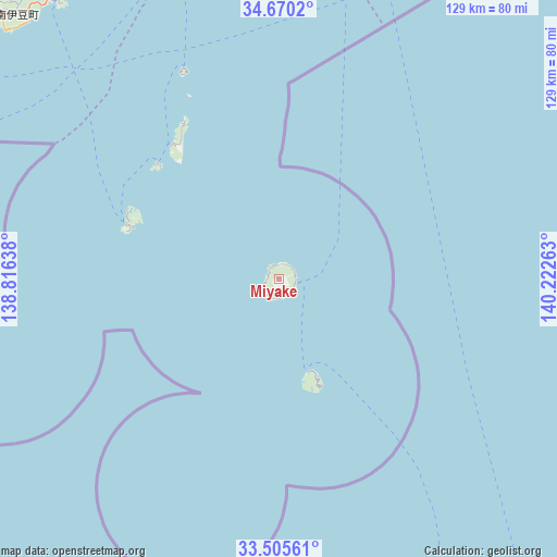
Miyake GPS coordinates[2]
34° 5' 23.676" North, 139° 31' 10.2" East
| Map corner | latitude | longitude |
|---|---|---|
| Upper-left | 34.6702°, | 138.81638° |
| Center: | 34.08991°, | 139.5195° |
| Lower-right: | 33.50561°, | 140.22263° |
| Map W x H: | 129.5×129.5 km | = 80.5×80.5mi |
| max Lat: | 45.40944° ⇑78.6% North |
| Miyake: | 34.08991° |
| min Lat: | ⇓21.4% South 24.34478° |
| min Long | Miyake | max Long |
| 123° | 139.5195° | 145.575° |
| W 69.3%⇐ | ⇒30.7% E |
Elevation
Elevation of Miyake is 696 m = 2283 ft, and this is 611.4 m = 2006 ft above average elevation for this country.
| Max E: |
1086 m = 3563 ft | 1.4% |
| Miyake | 696 m 2283 ft | |
| Avg. | 84.6 m = 278 ft | |
Min E: |
-2 m = -7 ft | 98.6% |
See also: Japan elevation on elevation.city.
Geographical zone
Miyake is located in North temperate zone (between Tropic of Cancer and the Arctic Circle). Distance of this Northern Tropic circle is 1184.5 km =736 mi to South.| Distance of | km | miles | from Miyake |
|---|---|---|---|
| North Pole | 6216.6 | 3862.8 | to North |
| Arctic Circle | 3610.7 | 2243.6 | to North |
| Tropic Cancer | 1184.5 | 736 | to South |
| Equator | 3790.4 | 2355.2 | to South |


Nearby cities:
15 places around Miyake: (largest is in red/bold)
• Atami
118.9 km =73.9 mi,  338°
338°
• Hachijō
112.4 km =69.8 mi,  167°
167°
• Heda
118.1 km =73.4 mi,  325°
325°
• Itō
105.4 km =65.5 mi, 337°
• Izu
111.2 km =69.1 mi, 331°
• Izunokuni
117.7 km =73.1 mi, 333°
• Kamogawa
123.9 km =77 mi,  25°
25°
• Minamibōsō
111.1 km =69 mi,  19°
19°
• Mishima
126.8 km =78.8 mi, 334°
• Miura
117.1 km =72.8 mi,  4°
4°
• Numazu
127.2 km =79 mi, 331°
• Shimoda
83.9 km =52.1 mi,  321°
321°
• Tateyama
104.3 km =64.8 mi, 17°
• Yugawara
124.9 km =77.6 mi, 340°
• Ōshima
74.6 km =46.4 mi,  348°
348°
Sources, notices
• [Note1] Compared only with cities in Japan existing in our database
• [Src1] Map data: © OpenStreetMap contributors (CC-BY-SA)
• [Src2] Other city data from geonames.org with taken over terms of usage.
• [Src3] Geographical zone / Annual Mean Temperature by Robert A. Rohde @ Wikipedia
