Boz-Adyr geodata
Boz-Adyr (Batken) is a seat of a third-order administrative division; located in Kyrgyzstan in Asia/Bishkek (GMT+6) time zone. In our database, there are 37 cities with bigger population. Compared to other cities in Kyrgyzstan, 82.1% of cities are located further ↑North; 82.1% of cities are located further →East and 54.8% of cities have lower elevation than Boz-Adyr. Note1


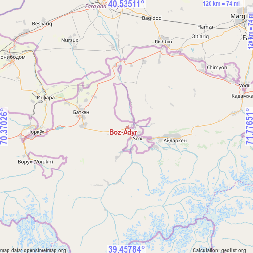
Boz-Adyr GPS coordinates[2]
39° 59' 54.96" North, 71° 4' 24.168" East
| Map corner | latitude | longitude |
|---|---|---|
| Upper-left | 40.53511°, | 70.37026° |
| Center: | 39.9986°, | 71.07338° |
| Lower-right: | 39.45784°, | 71.77651° |
| Map W x H: | 119.8×119.8 km | = 74.4×74.4mi |
| max Lat: | 42.89106° ⇑82.1% North |
| Boz-Adyr: | 39.9986° |
| min Lat: | ⇓17.9% South 39.55274° |
| min Long | Boz-Adyr | max Long |
| 69.3716° | 71.07338° | 78.52702° |
| W 17.9%⇐ | ⇒82.1% E |
Elevation
Elevation of Boz-Adyr is 1185 m = 3888 ft, and this is 16.4 m = 54 ft below average elevation for this country.
| Max E: |
2638 m = 8655 ft | 45.2% |
| Avg. | 1201.4 m = 3942 ft | |
| Boz-Adyr | 1185 m = 3888 ft | |
Min E: |
504 m = 1654 ft | 54.8% |
See also: Kyrgyzstan elevation on elevation.city.
Geographical zone
Boz-Adyr is located in North temperate zone (between Tropic of Cancer and the Arctic Circle). Distance of this Northern Tropic circle is 1841.5 km =1144.3 mi to South.| Distance of | km | miles | from Boz-Adyr |
|---|---|---|---|
| North Pole | 5559.6 | 3454.6 | to North |
| Arctic Circle | 2953.7 | 1835.3 | to North |
| Tropic Cancer | 1841.5 | 1144.3 | to South |
| Equator | 4447.4 | 2763.5 | to South |


Nearby cities:
15 places around Boz-Adyr: (largest is in red/bold)
• Ak-Say
49 km =30.4 mi,  253°
253°
• Ak-Tatyr
50.4 km =31.3 mi,  265°
265°
• Alga
44.8 km =27.8 mi,  53°
53°
• Aydarken
23.7 km =14.7 mi,  105°
105°
• Batken
22.8 km =14.2 mi,  288°
288°
• Chek
22.9 km =14.2 mi,  302°
302°
• Kara-Bak
28.2 km =17.5 mi,  310°
310°
• Khalmion
53.2 km =33.1 mi,  63°
63°
• Kyrgyz-Kyshtak
41.9 km =26 mi,  34°
34°
• Kyzyl-Bulak
56.8 km =35.3 mi,  84°
84°
• Ormosh
17 km =10.6 mi, 110°
• Orozbekovo
51.2 km =31.8 mi, 82°
• Pulgon
58.2 km =36.2 mi,  73°
73°
• Samarkandyk
44.9 km =27.9 mi, 269°
• Tayan
11.1 km =6.9 mi,  164°
164°
Sources, notices
• [Note1] Compared only with cities in Kyrgyzstan existing in our database
• [Src1] Map data: © OpenStreetMap contributors (CC-BY-SA)
• [Src2] Other city data from geonames.org with taken over terms of usage.
• [Src3] Geographical zone / Annual Mean Temperature by Robert A. Rohde @ Wikipedia
