Aydarken geodata
Aydarken (Batken) is a populated place; located in Kyrgyzstan in Asia/Bishkek (GMT+6) time zone. With population of 11,857 people, there are 26 cities with bigger population in this country. Compared to other cities in Kyrgyzstan, 86.9% of cities are located further ↑North; 77.4% of cities are located further →East and 92.9% of cities have lower elevation than Aydarken. Note1


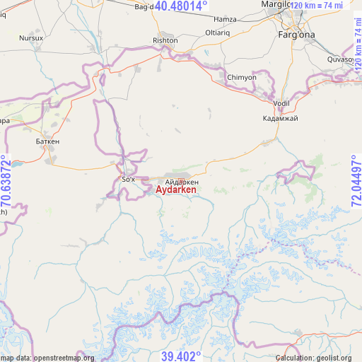
Aydarken GPS coordinates[2]
39° 56' 35.484" North, 71° 20' 30.624" East
| Map corner | latitude | longitude |
|---|---|---|
| Upper-left | 40.48014°, | 70.63872° |
| Center: | 39.94319°, | 71.34184° |
| Lower-right: | 39.402°, | 72.04497° |
| Map W x H: | 119.9×119.9 km | = 74.5×74.5mi |
| max Lat: | 42.89106° ⇑86.9% North |
| Aydarken: | 39.94319° |
| min Lat: | ⇓13.1% South 39.55274° |
| min Long | Aydarken | max Long |
| 69.3716° | 71.34184° | 78.52702° |
| W 22.6%⇐ | ⇒77.4% E |
Elevation
Elevation of Aydarken is 1928 m = 6325 ft, and this is 726.6 m = 2384 ft above average elevation for this country.
| Max E: |
2638 m = 8655 ft | 7.1% |
| Aydarken | 1928 m 6325 ft | |
| Avg. | 1201.4 m = 3942 ft | |
Min E: |
504 m = 1654 ft | 92.9% |
See also: Kyrgyzstan elevation on elevation.city.
Geographical zone
Aydarken is located in North temperate zone (between Tropic of Cancer and the Arctic Circle). Distance of this Northern Tropic circle is 1835.3 km =1140.4 mi to South.| Distance of | km | miles | from Aydarken |
|---|---|---|---|
| North Pole | 5565.8 | 3458.4 | to North |
| Arctic Circle | 2959.9 | 1839.2 | to North |
| Tropic Cancer | 1835.3 | 1140.4 | to South |
| Equator | 4441.3 | 2759.7 | to South |


Nearby cities:
15 places around Aydarken: (largest is in red/bold)
• Alga
35.2 km =21.9 mi,  22°
22°
• Batken
46.4 km =28.8 mi,  286°
286°
• Boz-Adyr
23.7 km =14.7 mi, 285°
• Chek
46.1 km =28.6 mi, 293°
• Kara-Bak
50.7 km =31.5 mi,  298°
298°
• Kara-Dzhygach
66.9 km =41.6 mi,  72°
72°
• Khalmion
38.8 km =24.1 mi,  39°
39°
• Kyrgyz-Kyshtak
40.9 km =25.4 mi,  0°
0°
• Kyzyl-Bulak
35.8 km =22.2 mi, 70°
• Markaz
57.8 km =35.9 mi,  55°
55°
• Ormosh
6.9 km =4.3 mi,  272°
272°
• Orozbekovo
30.6 km =19 mi, 65°
• Pulgon
40.1 km =24.9 mi, 55°
• Samarkandyk
68.1 km =42.3 mi,  275°
275°
• Tayan
20.4 km =12.7 mi,  257°
257°
Sources, notices
• [Note1] Compared only with cities in Kyrgyzstan existing in our database
• [Src1] Map data: © OpenStreetMap contributors (CC-BY-SA)
• [Src2] Other city data from geonames.org with taken over terms of usage.
• [Src3] Geographical zone / Annual Mean Temperature by Robert A. Rohde @ Wikipedia
