Ak-Suu geodata
Ak-Suu (Batken) is a seat of a third-order administrative division; located in Kyrgyzstan in Asia/Bishkek (GMT+6) time zone. In our database, there are 37 cities with bigger population. Compared to other cities in Kyrgyzstan, 90.5% of cities are located further ↑North; 100% of cities are located further →East and 69% of cities have higher elevation than Ak-Suu. Note1


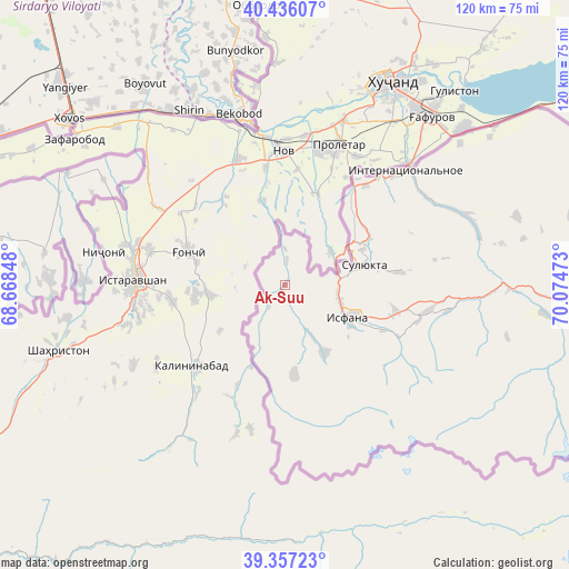
Ak-Suu GPS coordinates[2]
39° 53' 55.572" North, 69° 22' 17.76" East
| Map corner | latitude | longitude |
|---|---|---|
| Upper-left | 40.43607°, | 68.66848° |
| Center: | 39.89877°, | 69.3716° |
| Lower-right: | 39.35723°, | 70.07473° |
| Map W x H: | 120×120 km | = 74.6×74.6mi |
| max Lat: | 42.89106° ⇑90.5% North |
| Ak-Suu: | 39.89877° |
| min Lat: | ⇓9.5% South 39.55274° |
| min Long | Ak-Suu | max Long |
| 69.3716° | 69.3716° | 78.52702° |
| W 0%⇐ | ⇒100% E |
Elevation
Elevation of Ak-Suu is 909 m = 2982 ft, and this is 292.4 m = 959 ft below average elevation for this country.
| Max E: |
2638 m = 8655 ft | 69% |
| Avg. | 1201.4 m = 3942 ft | |
| Ak-Suu | 909 m = 2982 ft | |
Min E: |
504 m = 1654 ft | 31% |
See also: Kyrgyzstan elevation on elevation.city.
Geographical zone
Ak-Suu is located in North temperate zone (between Tropic of Cancer and the Arctic Circle). Distance of this Northern Tropic circle is 1830.4 km =1137.4 mi to South.| Distance of | km | miles | from Ak-Suu |
|---|---|---|---|
| North Pole | 5570.7 | 3461.5 | to North |
| Arctic Circle | 2964.8 | 1842.2 | to North |
| Tropic Cancer | 1830.4 | 1137.4 | to South |
| Equator | 4436.3 | 2756.6 | to South |


Nearby cities:
15 places around Ak-Suu: (largest is in red/bold)
• Ak-Say
98.2 km =61 mi,  91°
91°
• Ak-Tatyr
95.1 km =59.1 mi, 85°
• Andarak
16.5 km =10.3 mi,  151°
151°
• Batken
124.7 km =77.5 mi,  81°
81°
• Beshkent
40.8 km =25.4 mi,  68°
68°
• Boz-Adyr
145.5 km =90.4 mi, 85°
• Chek
127.8 km =79.4 mi, 79°
• Isfana
14.9 km =9.3 mi,  116°
116°
• Kara-Bak
126.7 km =78.7 mi, 76°
• Katran
55.2 km =34.3 mi,  96°
96°
• Korgon
48.1 km =29.9 mi, 91°
• Kulundu
32.6 km =20.3 mi,  44°
44°
• Samarkandyk
100.7 km =62.6 mi, 83°
• Suluktu
17.2 km =10.7 mi, 75°
• Toguz-Bulak
29.8 km =18.5 mi, 101°
Sources, notices
• [Note1] Compared only with cities in Kyrgyzstan existing in our database
• [Src1] Map data: © OpenStreetMap contributors (CC-BY-SA)
• [Src2] Other city data from geonames.org with taken over terms of usage.
• [Src3] Geographical zone / Annual Mean Temperature by Robert A. Rohde @ Wikipedia
