Suluktu geodata
Suluktu (Batken) is a populated place; located in Kyrgyzstan in Asia/Bishkek (GMT+6) time zone. With population of 15,019 people, there are 21 cities with bigger population in this country. Compared to other cities in Kyrgyzstan, 88.1% of cities are located further ↑North; 96.4% of cities are located further →East and 64.3% of cities have lower elevation than Suluktu. Note1


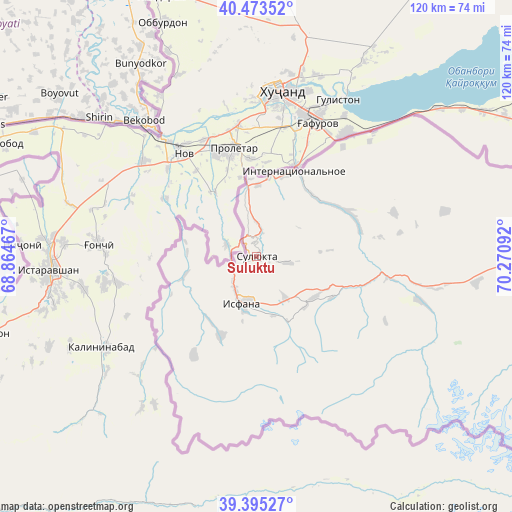
Suluktu GPS coordinates[2]
39° 56' 11.472" North, 69° 34' 4.044" East
| Map corner | latitude | longitude |
|---|---|---|
| Upper-left | 40.47352°, | 68.86467° |
| Center: | 39.93652°, | 69.56779° |
| Lower-right: | 39.39527°, | 70.27092° |
| Map W x H: | 119.9×119.9 km | = 74.5×74.5mi |
| max Lat: | 42.89106° ⇑88.1% North |
| Suluktu: | 39.93652° |
| min Lat: | ⇓11.9% South 39.55274° |
| min Long | Suluktu | max Long |
| 69.3716° | 69.56779° | 78.52702° |
| W 3.6%⇐ | ⇒96.4% E |
Elevation
Elevation of Suluktu is 1251 m = 4104 ft, and this is 49.6 m = 163 ft above average elevation for this country.
| Max E: |
2638 m = 8655 ft | 35.7% |
| Suluktu | 1251 m 4104 ft | |
| Avg. | 1201.4 m = 3942 ft | |
Min E: |
504 m = 1654 ft | 64.3% |
See also: Kyrgyzstan elevation on elevation.city.
Geographical zone
Suluktu is located in North temperate zone (between Tropic of Cancer and the Arctic Circle). Distance of this Northern Tropic circle is 1834.6 km =1140 mi to South.| Distance of | km | miles | from Suluktu |
|---|---|---|---|
| North Pole | 5566.5 | 3458.9 | to North |
| Arctic Circle | 2960.6 | 1839.6 | to North |
| Tropic Cancer | 1834.6 | 1140 | to South |
| Equator | 4440.5 | 2759.2 | to South |


Nearby cities:
15 places around Suluktu: (largest is in red/bold)
• Ak-Say
81.7 km =50.8 mi,  94°
94°
• Ak-Suu
17.2 km =10.7 mi,  255°
255°
• Ak-Tatyr
78.2 km =48.6 mi, 88°
• Andarak
20.7 km =12.9 mi,  205°
205°
• Batken
107.5 km =66.8 mi,  82°
82°
• Beshkent
23.8 km =14.8 mi,  63°
63°
• Boz-Adyr
128.5 km =79.8 mi, 86°
• Chek
110.5 km =68.7 mi, 79°
• Isfana
11.4 km =7.1 mi,  197°
197°
• Kara-Bak
109.4 km =68 mi, 76°
• Katran
39.5 km =24.5 mi,  105°
105°
• Korgon
31.8 km =19.8 mi,  99°
99°
• Kulundu
19.9 km =12.4 mi,  18°
18°
• Samarkandyk
83.6 km =51.9 mi, 85°
• Toguz-Bulak
16.2 km =10.1 mi,  129°
129°
Sources, notices
• [Note1] Compared only with cities in Kyrgyzstan existing in our database
• [Src1] Map data: © OpenStreetMap contributors (CC-BY-SA)
• [Src2] Other city data from geonames.org with taken over terms of usage.
• [Src3] Geographical zone / Annual Mean Temperature by Robert A. Rohde @ Wikipedia
