Andarak geodata
Andarak (Batken) is a seat of a third-order administrative division; located in Kyrgyzstan in Asia/Bishkek (GMT+6) time zone. In our database, there are 37 cities with bigger population. Compared to other cities in Kyrgyzstan, 97.6% of cities are located further ↑North; 98.8% of cities are located further →East and 76.2% of cities have lower elevation than Andarak. Note1


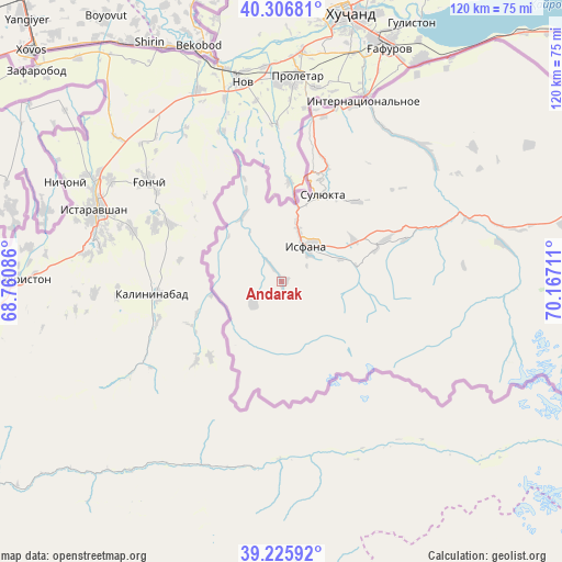
Andarak GPS coordinates[2]
39° 46' 6.564" North, 69° 27' 50.328" East
| Map corner | latitude | longitude |
|---|---|---|
| Upper-left | 40.30681°, | 68.76086° |
| Center: | 39.76849°, | 69.46398° |
| Lower-right: | 39.22592°, | 70.16711° |
| Map W x H: | 120.2×120.2 km | = 74.7×74.7mi |
| max Lat: | 42.89106° ⇑97.6% North |
| Andarak: | 39.76849° |
| min Lat: | ⇓2.4% South 39.55274° |
| min Long | Andarak | max Long |
| 69.3716° | 69.46398° | 78.52702° |
| W 1.2%⇐ | ⇒98.8% E |
Elevation
Elevation of Andarak is 1601 m = 5253 ft, and this is 399.6 m = 1311 ft above average elevation for this country.
| Max E: |
2638 m = 8655 ft | 23.8% |
| Andarak | 1601 m 5253 ft | |
| Avg. | 1201.4 m = 3942 ft | |
Min E: |
504 m = 1654 ft | 76.2% |
See also: Kyrgyzstan elevation on elevation.city.
Geographical zone
Andarak is located in North temperate zone (between Tropic of Cancer and the Arctic Circle). Distance of this Northern Tropic circle is 1815.9 km =1128.3 mi to South.| Distance of | km | miles | from Andarak |
|---|---|---|---|
| North Pole | 5585.2 | 3470.5 | to North |
| Arctic Circle | 2979.3 | 1851.3 | to North |
| Tropic Cancer | 1815.9 | 1128.3 | to South |
| Equator | 4421.8 | 2747.6 | to South |


Nearby cities:
15 places around Andarak: (largest is in red/bold)
• Ak-Say
91.1 km =56.6 mi,  82°
82°
• Ak-Suu
16.5 km =10.3 mi,  331°
331°
• Ak-Tatyr
89.7 km =55.7 mi, 76°
• Batken
120.1 km =74.6 mi,  74°
74°
• Beshkent
42 km =26.1 mi,  46°
46°
• Boz-Adyr
139.7 km =86.8 mi, 79°
• Chek
123.8 km =76.9 mi, 72°
• Isfana
9.5 km =5.9 mi,  34°
34°
• Kara-Bak
123.5 km =76.7 mi, 69°
• Katran
47.8 km =29.7 mi, 79°
• Korgon
42.4 km =26.3 mi, 71°
• Kulundu
40.5 km =25.2 mi,  21°
21°
• Samarkandyk
95.8 km =59.5 mi, 74°
• Suluktu
20.7 km =12.9 mi, 25°
• Toguz-Bulak
22.9 km =14.2 mi, 68°
Sources, notices
• [Note1] Compared only with cities in Kyrgyzstan existing in our database
• [Src1] Map data: © OpenStreetMap contributors (CC-BY-SA)
• [Src2] Other city data from geonames.org with taken over terms of usage.
• [Src3] Geographical zone / Annual Mean Temperature by Robert A. Rohde @ Wikipedia
