Thma Puok geodata
Thma Puok (Banteay Meanchey) is a seat of a second-order administrative division; located in Cambodia in Asia/Phnom_Penh (GMT+7) time zone. In our database, there are 29 cities with bigger population. Compared to other cities in Cambodia, 96.2% of cities are located further ↓South; 87.1% of cities are located further →East and 71.2% of cities have lower elevation than Thma Puok. Note1


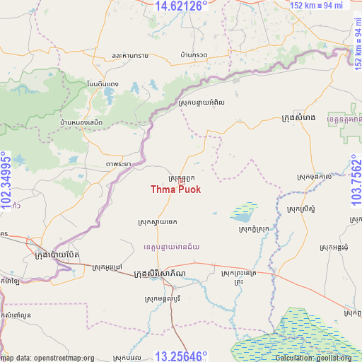
Thma Puok GPS coordinates[2]
13° 56' 23.532" North, 103° 3' 11.052" East
| Map corner | latitude | longitude |
|---|---|---|
| Upper-left | 14.62126°, | 102.34995° |
| Center: | 13.93987°, | 103.05307° |
| Lower-right: | 13.25646°, | 103.7562° |
| Map W x H: | 151.8×151.8 km | = 94.3×94.3mi |
| max Lat: | 14.23223° ⇑3.8% North |
| Thma Puok: | 13.93987° |
| min Lat: | ⇓96.2% South 10.48291° |
| min Long | Thma Puok | max Long |
| 102.37574° | 103.05307° | 107.42393° |
| W 12.9%⇐ | ⇒87.1% E |
Elevation
Elevation of Thma Puok is 42 m = 138 ft, and this is 10 m = 33 ft below average elevation for this country.
| Max E: |
678 m = 2224 ft | 28.8% |
| Avg. | 52 m = 171 ft | |
| Thma Puok | 42 m = 138 ft | |
Min E: |
4 m = 13 ft | 71.2% |
See also: Cambodia elevation on elevation.city.
Geographical zone
Thma Puok is located in North Torrid zone (between Equator and Tropic of Cancer). Distance of this Northern Tropic circle is 1056 km =656.2 mi to North.| Distance of | km | miles | from Thma Puok |
|---|---|---|---|
| North Pole | 8457.1 | 5255 | to North |
| Arctic Circle | 5851.2 | 3635.8 | to North |
| Tropic Cancer | 1056 | 656.2 | to North |
| Equator | 1550 | 963.1 | to South |


Nearby cities:
15 places around Thma Puok: (largest is in red/bold)
• Aek Phnum
88.8 km =55.2 mi,  167°
167°
• Angkor Chum
70.3 km =43.7 mi,  113°
113°
• Bat Dambang
75.4 km =46.9 mi,  176°
176°
• Bavel
78.9 km =49 mi,  193°
193°
• Kralanh
54.3 km =33.7 mi,  133°
133°
• Mongkol Borei
44.5 km =27.7 mi, 183°
• Ou Chrov
60.8 km =37.8 mi,  236°
236°
• Paoy Paet
61.4 km =38.2 mi, 239°
• Phnum Srok
37.8 km =23.5 mi, 125°
• Preah Netr Preah
37.8 km =23.5 mi,  158°
158°
• Samraong
56.9 km =35.4 mi,  61°
61°
• Sisophon
40.3 km =25 mi, 192°
• Srei Snam
51 km =31.7 mi,  103°
103°
• Svay Chek
17.9 km =11.1 mi,  213°
213°
• Varin
78.1 km =48.5 mi, 102°
Sources, notices
• [Note1] Compared only with cities in Cambodia existing in our database
• [Src1] Map data: © OpenStreetMap contributors (CC-BY-SA)
• [Src2] Other city data from geonames.org with taken over terms of usage.
• [Src3] Geographical zone / Annual Mean Temperature by Robert A. Rohde @ Wikipedia
