Rumduol geodata
Rumduol (Svay Rieng) is a seat of a second-order administrative division; located in Cambodia in Asia/Phnom_Penh (GMT+7) time zone. In our database, there are 29 cities with bigger population. Compared to other cities in Cambodia, 80.3% of cities are located further ↑North; 85.6% of cities are located further ←West and 93.9% of cities have higher elevation than Rumduol. Note1


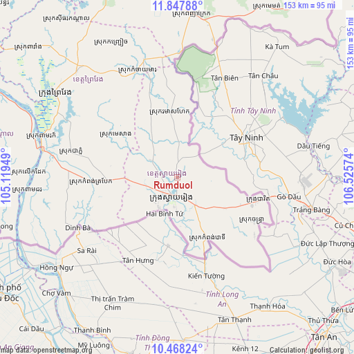
Rumduol GPS coordinates[2]
11° 9' 31.968" North, 105° 49' 21.396" East
| Map corner | latitude | longitude |
|---|---|---|
| Upper-left | 11.84788°, | 105.11949° |
| Center: | 11.15888°, | 105.82261° |
| Lower-right: | 10.46824°, | 106.52574° |
| Map W x H: | 153.4×153.4 km | = 95.3×95.3mi |
| max Lat: | 14.23223° ⇑80.3% North |
| Rumduol: | 11.15888° |
| min Lat: | ⇓19.7% South 10.48291° |
| min Long | Rumduol | max Long |
| 102.37574° | 105.82261° | 107.42393° |
| W 85.6%⇐ | ⇒14.4% E |
Elevation
Elevation of Rumduol is 7 m = 23 ft, and this is 45 m = 148 ft below average elevation for this country.
| Max E: |
678 m = 2224 ft | 93.9% |
| Avg. | 52 m = 171 ft | |
| Rumduol | 7 m = 23 ft | |
Min E: |
4 m = 13 ft | 6.1% |
See also: Cambodia elevation on elevation.city.
Geographical zone
Rumduol is located in North Torrid zone (between Equator and Tropic of Cancer). Distance of Equator is 1240.8 km =771 mi to South.| Distance of | km | miles | from Rumduol |
|---|---|---|---|
| North Pole | 8766.3 | 5447.1 | to North |
| Arctic Circle | 6160.4 | 3827.9 | to North |
| Tropic Cancer | 1365.2 | 848.3 | to North |
| Equator | 1240.8 | 771 | to South |


Nearby cities:
15 places around Rumduol: (largest is in red/bold)
• Chantrea
38.3 km =23.8 mi,  120°
120°
• Kampong Leav
64.1 km =39.8 mi,  305°
305°
• Kampong Trabaek
37.1 km =23.1 mi,  267°
267°
• Koah Thum
83.6 km =51.9 mi, 267°
• Leuk Daek
64.8 km =40.3 mi, 271°
• Me Sang
35.5 km =22.1 mi,  301°
301°
• Peam Chor
66 km =41 mi,  264°
264°
• Peam Ro
61.1 km =38 mi,  285°
285°
• Preah Sdach
48.3 km =30 mi, 261°
• Prey Veaeng
63.4 km =39.4 mi,  316°
316°
• Prey Veng
65.3 km =40.6 mi, 303°
• Sithor Kandal
83.4 km =51.8 mi, 324°
• Suong
85.6 km =53.2 mi,  347°
347°
• Svay Rieng
8.3 km =5.2 mi,  197°
197°
• Svay Teab
13.5 km =8.4 mi,  149°
149°
Sources, notices
• [Note1] Compared only with cities in Cambodia existing in our database
• [Src1] Map data: © OpenStreetMap contributors (CC-BY-SA)
• [Src2] Other city data from geonames.org with taken over terms of usage.
• [Src3] Geographical zone / Annual Mean Temperature by Robert A. Rohde @ Wikipedia
