Chantrea geodata
Chantrea (Svay Rieng) is a seat of a second-order administrative division; located in Cambodia in Asia/Phnom_Penh (GMT+7) time zone. In our database, there are 29 cities with bigger population. Compared to other cities in Cambodia, 89.4% of cities are located further ↑North; 90.9% of cities are located further ←West and 93.9% of cities have higher elevation than Chantrea. Note1


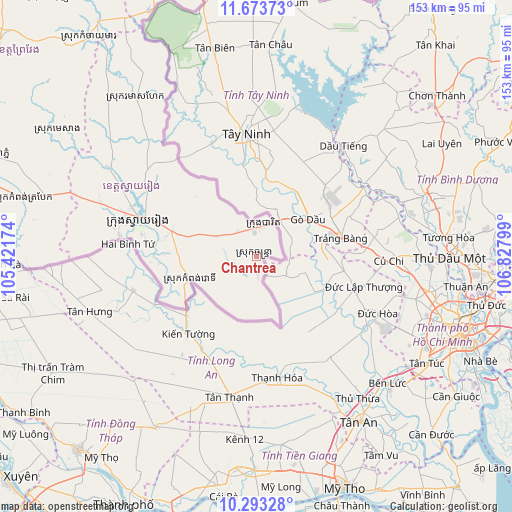
Chantrea GPS coordinates[2]
10° 59' 3.516" North, 106° 7' 29.496" East
| Map corner | latitude | longitude |
|---|---|---|
| Upper-left | 11.67373°, | 105.42174° |
| Center: | 10.98431°, | 106.12486° |
| Lower-right: | 10.29328°, | 106.82799° |
| Map W x H: | 153.5×153.5 km | = 95.4×95.4mi |
| max Lat: | 14.23223° ⇑89.4% North |
| Chantrea: | 10.98431° |
| min Lat: | ⇓10.6% South 10.48291° |
| min Long | Chantrea | max Long |
| 102.37574° | 106.12486° | 107.42393° |
| W 90.9%⇐ | ⇒9.1% E |
Elevation
Elevation of Chantrea is 7 m = 23 ft, and this is 45 m = 148 ft below average elevation for this country.
| Max E: |
678 m = 2224 ft | 93.9% |
| Avg. | 52 m = 171 ft | |
| Chantrea | 7 m = 23 ft | |
Min E: |
4 m = 13 ft | 6.1% |
See also: Cambodia elevation on elevation.city.
Geographical zone
Chantrea is located in North Torrid zone (between Equator and Tropic of Cancer). Distance of Equator is 1221.3 km =758.9 mi to South.| Distance of | km | miles | from Chantrea |
|---|---|---|---|
| North Pole | 8785.7 | 5459.2 | to North |
| Arctic Circle | 6179.8 | 3839.9 | to North |
| Tropic Cancer | 1384.6 | 860.4 | to North |
| Equator | 1221.3 | 758.9 | to South |


Nearby cities:
15 places around Chantrea: (largest is in red/bold)
• Kampong Leav
102.3 km =63.6 mi,  303°
303°
• Kampong Trabaek
72.3 km =44.9 mi,  284°
284°
• Koah Thum
117.5 km =73 mi, 277°
• Leuk Daek
100 km =62.1 mi, 282°
• Me Sang
73.8 km =45.9 mi, 301°
• Peam Chor
99.4 km =61.8 mi, 277°
• Peam Ro
98.6 km =61.3 mi,  291°
291°
• Preah Sdach
81.7 km =50.8 mi, 278°
• Prey Veaeng
100.8 km =62.6 mi,  310°
310°
• Prey Veng
103.6 km =64.4 mi, 302°
• Rumduol
38.3 km =23.8 mi, 300°
• Sithor Kandal
119.3 km =74.1 mi,  317°
317°
• Suong
115 km =71.5 mi,  333°
333°
• Svay Rieng
37.3 km =23.2 mi, 287°
• Svay Teab
27.3 km =17 mi, 286°
Sources, notices
• [Note1] Compared only with cities in Cambodia existing in our database
• [Src1] Map data: © OpenStreetMap contributors (CC-BY-SA)
• [Src2] Other city data from geonames.org with taken over terms of usage.
• [Src3] Geographical zone / Annual Mean Temperature by Robert A. Rohde @ Wikipedia
