Patsi geodata
Patsi (Anjouan) is a populated place; located in Comoros in Indian/Comoro (GMT+3) time zone. With population of 1,498 people, there are 64 cities with bigger population in this country. Compared to other cities in Comoros, 54.9% of cities are located further ↑North; 82.3% of cities are located further ←West and 77% of cities have lower elevation than Patsi. Note1


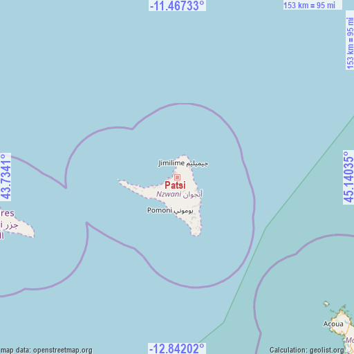
Patsi GPS coordinates[2]
12° 9' 20.016" South, 44° 26' 13.992" East
| Map corner | latitude | longitude |
|---|---|---|
| Upper-left | -11.46733°, | 43.7341° |
| Center: | -12.15556°, | 44.43722° |
| Lower-right: | -12.84202°, | 45.14035° |
| Map W x H: | 152.9×152.9 km | = 95×95mi |
| max Lat: | -11.38472° ⇑54.9% North |
| Patsi: | -12.15556° |
| min Lat: | ⇓45.1% South -12.37306° |
| min Long | Patsi | max Long |
| 43.2525° | 44.43722° | 44.53194° |
| W 82.3%⇐ | ⇒17.7% E |
Elevation
Elevation of Patsi is 284 m = 932 ft, and this is 87.9 m = 288 ft above average elevation for this country.
| Max E: |
924 m = 3031 ft | 23% |
| Patsi | 284 m 932 ft | |
| Avg. | 196.1 m = 643 ft | |
Min E: |
1 m = 3 ft | 77% |
See also: Comoros elevation on elevation.city.
Geographical zone
Patsi is located in South Torrid zone (between Equator and Tropic of Capricorn). Distance of this Southern Tropic circle is 1254.3 km =779.4 mi to South.| Distance of | km | miles | from Patsi |
|---|---|---|---|
| Equator | 1351.6 | 839.8 | to North |
| Tropic Capricorn | 1254.3 | 779.4 | to South |
| Antarctic Circle | 6049.6 | 3759 | to South |
| South Pole | 8655.5 | 5378.3 | to South |


Nearby cities:
15 places around Patsi: (largest is in red/bold)
• Barakani
2 km =1.2 mi,  338°
338°
• Chandra
5.3 km =3.3 mi,  145°
145°
• Dziani
5.9 km =3.7 mi,  121°
121°
• Hajoho
6.6 km =4.1 mi,  58°
58°
• Harembo
6.7 km =4.2 mi,  85°
85°
• Koki
1.8 km =1.1 mi,  164°
164°
• Koni-Djodjo
9.6 km =6 mi, 149°
• Koni-Ngani
8.2 km =5.1 mi, 145°
• Mirontsi
3.2 km =2 mi,  267°
267°
• Mjimandra
8.3 km =5.2 mi,  241°
241°
• Moutsamoudou
4.3 km =2.7 mi,  253°
253°
• Ongoni
7.8 km =4.8 mi,  102°
102°
• Ouani
2.6 km =1.6 mi,  329°
329°
• Pajé
5.6 km =3.5 mi, 253°
• Tsimbeo
6.3 km =3.9 mi, 151°
Sources, notices
• [Note1] Compared only with cities in Comoros existing in our database
• [Src1] Map data: © OpenStreetMap contributors (CC-BY-SA)
• [Src2] Other city data from geonames.org with taken over terms of usage.
• [Src3] Geographical zone / Annual Mean Temperature by Robert A. Rohde @ Wikipedia
