Pajé geodata
Pajé (Anjouan) is a populated place; located in Comoros in Indian/Comoro (GMT+3) time zone. With population of 1,894 people, there are 52 cities with bigger population in this country. Compared to other cities in Comoros, 57.5% of cities are located further ↑North; 75.2% of cities are located further ←West and 83.2% of cities have higher elevation than Pajé. Note1


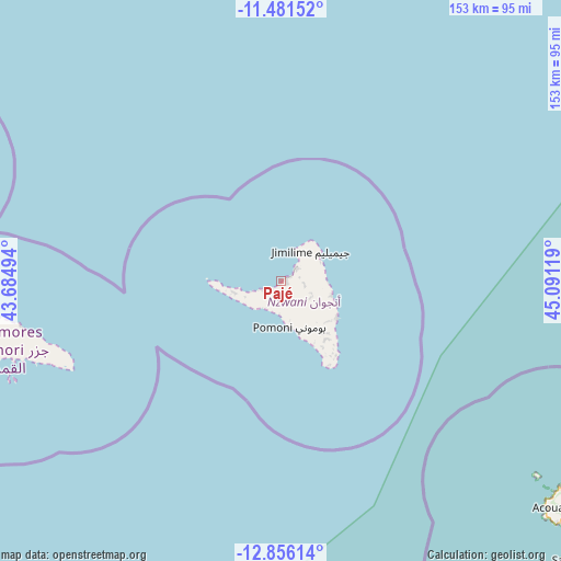
Pajé GPS coordinates[2]
12° 10' 10.992" South, 44° 23' 17.016" East
| Map corner | latitude | longitude |
|---|---|---|
| Upper-left | -11.48152°, | 43.68494° |
| Center: | -12.16972°, | 44.38806° |
| Lower-right: | -12.85614°, | 45.09119° |
| Map W x H: | 152.8×152.8 km | = 94.9×94.9mi |
| max Lat: | -11.38472° ⇑57.5% North |
| Pajé: | -12.16972° |
| min Lat: | ⇓42.5% South -12.37306° |
| min Long | Pajé | max Long |
| 43.2525° | 44.38806° | 44.53194° |
| W 75.2%⇐ | ⇒24.8% E |
Elevation
Elevation of Pajé is 30 m = 98 ft, and this is 166.1 m = 545 ft below average elevation for this country.
| Max E: |
924 m = 3031 ft | 83.2% |
| Avg. | 196.1 m = 643 ft | |
| Pajé | 30 m = 98 ft | |
Min E: |
1 m = 3 ft | 16.8% |
See also: Comoros elevation on elevation.city.
Geographical zone
Pajé is located in South Torrid zone (between Equator and Tropic of Capricorn). Distance of this Southern Tropic circle is 1252.8 km =778.5 mi to South.| Distance of | km | miles | from Pajé |
|---|---|---|---|
| Equator | 1353.1 | 840.8 | to North |
| Tropic Capricorn | 1252.8 | 778.5 | to South |
| Antarctic Circle | 6048 | 3758.1 | to South |
| South Pole | 8653.9 | 5377.3 | to South |


Nearby cities:
15 places around Pajé: (largest is in red/bold)
• Barakani
5.7 km =3.5 mi,  52°
52°
• Chandra
8.8 km =5.5 mi,  108°
108°
• Chironkamba
4.5 km =2.8 mi,  238°
238°
• Chitrouni
6 km =3.7 mi,  252°
252°
• Koki
5.8 km =3.6 mi,  91°
91°
• Lingoni
10.1 km =6.3 mi,  161°
161°
• Mirontsi
2.6 km =1.6 mi,  56°
56°
• Mjamaoué
8.9 km =5.5 mi, 252°
• Mjimandra
3.1 km =1.9 mi,  218°
218°
• Moutsamoudou
1.3 km =0.8 mi,  74°
74°
• Ouani
5.5 km =3.4 mi, 46°
• Patsi
5.6 km =3.5 mi, 73°
• Tsimbeo
9.2 km =5.7 mi,  115°
115°
• Vassy
8.5 km =5.3 mi, 215°
• Vouani
8.4 km =5.2 mi,  190°
190°
Sources, notices
• [Note1] Compared only with cities in Comoros existing in our database
• [Src1] Map data: © OpenStreetMap contributors (CC-BY-SA)
• [Src2] Other city data from geonames.org with taken over terms of usage.
• [Src3] Geographical zone / Annual Mean Temperature by Robert A. Rohde @ Wikipedia
