Mirontsi geodata
Mirontsi (Anjouan) is a populated place; located in Comoros in Indian/Comoro (GMT+3) time zone. With population of 10,168 people, there are 8 cities with bigger population in this country. Compared to other cities in Comoros, 55.8% of cities are located further ↑North; 77% of cities are located further ←West and 75.2% of cities have higher elevation than Mirontsi. Note1


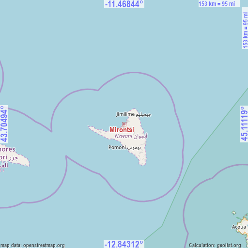
Mirontsi GPS coordinates[2]
12° 9' 24.012" South, 44° 24' 29.016" East
| Map corner | latitude | longitude |
|---|---|---|
| Upper-left | -11.46844°, | 43.70494° |
| Center: | -12.15667°, | 44.40806° |
| Lower-right: | -12.84312°, | 45.11119° |
| Map W x H: | 152.9×152.9 km | = 95×95mi |
| max Lat: | -11.38472° ⇑55.8% North |
| Mirontsi: | -12.15667° |
| min Lat: | ⇓44.2% South -12.37306° |
| min Long | Mirontsi | max Long |
| 43.2525° | 44.40806° | 44.53194° |
| W 77%⇐ | ⇒23% E |
Elevation
Elevation of Mirontsi is 50 m = 164 ft, and this is 146.1 m = 479 ft below average elevation for this country.
| Max E: |
924 m = 3031 ft | 75.2% |
| Avg. | 196.1 m = 643 ft | |
| Mirontsi | 50 m = 164 ft | |
Min E: |
1 m = 3 ft | 24.8% |
See also: Comoros elevation on elevation.city.
Geographical zone
Mirontsi is located in South Torrid zone (between Equator and Tropic of Capricorn). Distance of this Southern Tropic circle is 1254.2 km =779.3 mi to South.| Distance of | km | miles | from Mirontsi |
|---|---|---|---|
| Equator | 1351.7 | 839.9 | to North |
| Tropic Capricorn | 1254.2 | 779.3 | to South |
| Antarctic Circle | 6049.5 | 3759 | to South |
| South Pole | 8655.4 | 5378.2 | to South |


Nearby cities:
15 places around Mirontsi: (largest is in red/bold)
• Barakani
3.1 km =1.9 mi,  50°
50°
• Chandra
7.5 km =4.7 mi,  124°
124°
• Chironkamba
7.2 km =4.5 mi,  237°
237°
• Chitrouni
8.5 km =5.3 mi,  247°
247°
• Dziani
8.7 km =5.4 mi,  109°
109°
• Hajoho
9.5 km =5.9 mi,  67°
67°
• Harembo
9.8 km =6.1 mi,  86°
86°
• Koki
4 km =2.5 mi, 114°
• Koni-Ngani
10.2 km =6.3 mi,  130°
130°
• Mjimandra
5.7 km =3.5 mi,  226°
226°
• Moutsamoudou
1.5 km =0.9 mi,  219°
219°
• Ouani
3 km =1.9 mi,  37°
37°
• Pajé
2.6 km =1.6 mi, 236°
• Patsi
3.2 km =2 mi, 87°
• Tsimbeo
8.2 km =5.1 mi, 131°
Sources, notices
• [Note1] Compared only with cities in Comoros existing in our database
• [Src1] Map data: © OpenStreetMap contributors (CC-BY-SA)
• [Src2] Other city data from geonames.org with taken over terms of usage.
• [Src3] Geographical zone / Annual Mean Temperature by Robert A. Rohde @ Wikipedia
