Hajoho geodata
Hajoho (Anjouan) is a populated place; located in Comoros in Indian/Comoro (GMT+3) time zone. With population of 2,505 people, there are 37 cities with bigger population in this country. Compared to other cities in Comoros, 51.3% of cities are located further ↑North; 91.2% of cities are located further ←West and 58.4% of cities have higher elevation than Hajoho. Note1


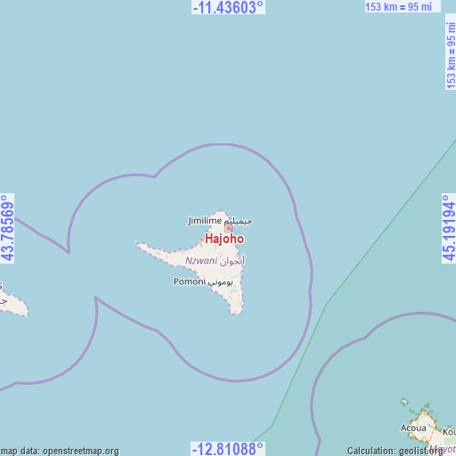
Hajoho GPS coordinates[2]
12° 7' 27.624" South, 44° 29' 19.716" East
| Map corner | latitude | longitude |
|---|---|---|
| Upper-left | -11.43603°, | 43.78569° |
| Center: | -12.12434°, | 44.48881° |
| Lower-right: | -12.81088°, | 45.19194° |
| Map W x H: | 152.9×152.9 km | = 95×95mi |
| max Lat: | -11.38472° ⇑51.3% North |
| Hajoho: | -12.12434° |
| min Lat: | ⇓48.7% South -12.37306° |
| min Long | Hajoho | max Long |
| 43.2525° | 44.48881° | 44.53194° |
| W 91.2%⇐ | ⇒8.8% E |
Elevation
Elevation of Hajoho is 103 m = 338 ft, and this is 93.1 m = 305 ft below average elevation for this country.
| Max E: |
924 m = 3031 ft | 58.4% |
| Avg. | 196.1 m = 643 ft | |
| Hajoho | 103 m = 338 ft | |
Min E: |
1 m = 3 ft | 41.6% |
See also: Comoros elevation on elevation.city.
Geographical zone
Hajoho is located in South Torrid zone (between Equator and Tropic of Capricorn). Distance of this Southern Tropic circle is 1257.8 km =781.6 mi to South.| Distance of | km | miles | from Hajoho |
|---|---|---|---|
| Equator | 1348.1 | 837.7 | to North |
| Tropic Capricorn | 1257.8 | 781.6 | to South |
| Antarctic Circle | 6053.1 | 3761.2 | to South |
| South Pole | 8659 | 5380.5 | to South |


Nearby cities:
15 places around Hajoho: (largest is in red/bold)
• Bambao
9.3 km =5.8 mi,  161°
161°
• Barakani
6.6 km =4.1 mi,  256°
256°
• Chandra
8.3 km =5.2 mi,  198°
198°
• Dziani
6.6 km =4.1 mi,  185°
185°
• Harembo
3.1 km =1.9 mi, 160°
• Koki
7.3 km =4.5 mi,  224°
224°
• Koni-Djodjo
11.7 km =7.3 mi,  183°
183°
• Koni-Ngani
10.2 km =6.3 mi, 185°
• Mirontsi
9.5 km =5.9 mi,  247°
247°
• Moutsamoudou
10.8 km =6.7 mi,  244°
244°
• Ongoni
5.5 km =3.4 mi, 158°
• Ouani
7.1 km =4.4 mi, 259°
• Pajé
12.1 km =7.5 mi, 245°
• Patsi
6.6 km =4.1 mi, 238°
• Tsimbeo
9.4 km =5.8 mi, 196°
Sources, notices
• [Note1] Compared only with cities in Comoros existing in our database
• [Src1] Map data: © OpenStreetMap contributors (CC-BY-SA)
• [Src2] Other city data from geonames.org with taken over terms of usage.
• [Src3] Geographical zone / Annual Mean Temperature by Robert A. Rohde @ Wikipedia
