Milévani geodata
Milévani (Grande Comore) is a populated place; located in Comoros in Indian/Comoro (GMT+3) time zone. With population of 729 people, there are 103 cities with bigger population in this country. Compared to other cities in Comoros, 84.1% of cities are located further ↓South; 77.9% of cities are located further →East and 59.3% of cities have lower elevation than Milévani. Note1


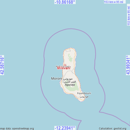
Milévani GPS coordinates[2]
11° 33' 5.004" South, 43° 17' 25.008" East
| Map corner | latitude | longitude |
|---|---|---|
| Upper-left | -10.86168°, | 42.58716° |
| Center: | -11.55139°, | 43.29028° |
| Lower-right: | -12.23941°, | 43.99341° |
| Map W x H: | 153.2×153.2 km | = 95.2×95.2mi |
| max Lat: | -11.38472° ⇑15.9% North |
| Milévani: | -11.55139° |
| min Lat: | ⇓84.1% South -12.37306° |
| min Long | Milévani | max Long |
| 43.2525° | 43.29028° | 44.53194° |
| W 22.1%⇐ | ⇒77.9% E |
Elevation
Elevation of Milévani is 164 m = 538 ft, and this is 32.1 m = 105 ft below average elevation for this country.
| Max E: |
924 m = 3031 ft | 40.7% |
| Avg. | 196.1 m = 643 ft | |
| Milévani | 164 m = 538 ft | |
Min E: |
1 m = 3 ft | 59.3% |
See also: Comoros elevation on elevation.city.
Geographical zone
Milévani is located in South Torrid zone (between Equator and Tropic of Capricorn). Distance of Equator is 1284.4 km =798.1 mi to North.| Distance of | km | miles | from Milévani |
|---|---|---|---|
| Equator | 1284.4 | 798.1 | to North |
| Tropic Capricorn | 1321.5 | 821.1 | to South |
| Antarctic Circle | 6116.8 | 3800.8 | to South |
| South Pole | 8722.7 | 5420 | to South |


Nearby cities:
15 places around Milévani: (largest is in red/bold)
• Bahani
9.8 km =6.1 mi,  183°
183°
• Batou
9.4 km =5.8 mi,  51°
51°
• Batsa
9.2 km =5.7 mi,  201°
201°
• Bibavou
2.7 km =1.7 mi,  211°
211°
• Héroumbili
9.8 km =6.1 mi,  85°
85°
• Mbéni
11 km =6.8 mi,  59°
59°
• Mnoungou
9.8 km =6.1 mi,  67°
67°
• Mtsamdou
11.6 km =7.2 mi,  122°
122°
• Ntsaouéni
10 km =6.2 mi,  342°
342°
• Oussivo
4.5 km =2.8 mi, 213°
• Sada-Chihoué
10.4 km =6.5 mi, 63°
• Vanadjou
6.4 km =4 mi,  193°
193°
• Vanambouani
7.8 km =4.8 mi, 211°
• Wela
11.4 km =7.1 mi, 185°
• Zivandani
10.8 km =6.7 mi, 194°
Sources, notices
• [Note1] Compared only with cities in Comoros existing in our database
• [Src1] Map data: © OpenStreetMap contributors (CC-BY-SA)
• [Src2] Other city data from geonames.org with taken over terms of usage.
• [Src3] Geographical zone / Annual Mean Temperature by Robert A. Rohde @ Wikipedia
