Mnoungou geodata
Mnoungou (Grande Comore) is a populated place; located in Comoros in Indian/Comoro (GMT+3) time zone. With population of 1,013 people, there are 87 cities with bigger population in this country. Compared to other cities in Comoros, 85.8% of cities are located further ↓South; 69% of cities are located further →East and 92% of cities have lower elevation than Mnoungou. Note1


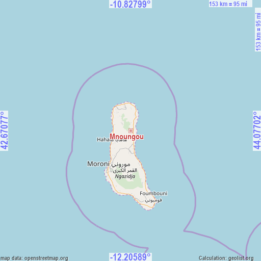
Mnoungou GPS coordinates[2]
11° 31' 4.008" South, 43° 22' 26.004" East
| Map corner | latitude | longitude |
|---|---|---|
| Upper-left | -10.82799°, | 42.67077° |
| Center: | -11.51778°, | 43.37389° |
| Lower-right: | -12.20589°, | 44.07702° |
| Map W x H: | 153.2×153.2 km | = 95.2×95.2mi |
| max Lat: | -11.38472° ⇑14.2% North |
| Mnoungou: | -11.51778° |
| min Lat: | ⇓85.8% South -12.37306° |
| min Long | Mnoungou | max Long |
| 43.2525° | 43.37389° | 44.53194° |
| W 31%⇐ | ⇒69% E |
Elevation
Elevation of Mnoungou is 515 m = 1690 ft, and this is 318.9 m = 1046 ft above average elevation for this country.
| Max E: |
924 m = 3031 ft | 8% |
| Mnoungou | 515 m 1690 ft | |
| Avg. | 196.1 m = 643 ft | |
Min E: |
1 m = 3 ft | 92% |
See also: Comoros elevation on elevation.city.
Geographical zone
Mnoungou is located in South Torrid zone (between Equator and Tropic of Capricorn). Distance of Equator is 1280.7 km =795.8 mi to North.| Distance of | km | miles | from Mnoungou |
|---|---|---|---|
| Equator | 1280.7 | 795.8 | to North |
| Tropic Capricorn | 1325.3 | 823.5 | to South |
| Antarctic Circle | 6120.5 | 3803.1 | to South |
| South Pole | 8726.4 | 5422.3 | to South |


Nearby cities:
15 places around Mnoungou: (largest is in red/bold)
• Bambadjani
4.4 km =2.7 mi,  4°
4°
• Batou
2.8 km =1.7 mi,  320°
320°
• Bibavou
12.2 km =7.6 mi,  239°
239°
• Bouni
3.8 km =2.4 mi,  24°
24°
• Chezani
9.9 km =6.2 mi,  14°
14°
• Chomoni
14 km =8.7 mi,  174°
174°
• Hantsindzi
10.4 km =6.5 mi, 22°
• Héroumbili
3 km =1.9 mi, 167°
• Itsandzéni
5.1 km =3.2 mi, 12°
• Mbéni
1.9 km =1.2 mi, 12°
• Milévani
9.8 km =6.1 mi,  247°
247°
• Mtsamdou
9.9 km =6.2 mi,  175°
175°
• Ntsaouéni
13.4 km =8.3 mi,  295°
295°
• Oussivo
13.8 km =8.6 mi, 237°
• Sada-Chihoué
1 km =0.6 mi, 14°
Sources, notices
• [Note1] Compared only with cities in Comoros existing in our database
• [Src1] Map data: © OpenStreetMap contributors (CC-BY-SA)
• [Src2] Other city data from geonames.org with taken over terms of usage.
• [Src3] Geographical zone / Annual Mean Temperature by Robert A. Rohde @ Wikipedia
