Batou geodata
Batou (Grande Comore) is a populated place; located in Comoros in Indian/Comoro (GMT+3) time zone. With population of 562 people, there are 109 cities with bigger population in this country. Compared to other cities in Comoros, 88.5% of cities are located further ↓South; 69.9% of cities are located further →East and 100% of cities have lower elevation than Batou. Note1


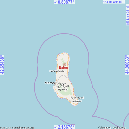
Batou GPS coordinates[2]
11° 29' 54.996" South, 43° 21' 27" East
| Map corner | latitude | longitude |
|---|---|---|
| Upper-left | -10.80877°, | 42.65438° |
| Center: | -11.49861°, | 43.3575° |
| Lower-right: | -12.18676°, | 44.06063° |
| Map W x H: | 153.2×153.2 km | = 95.2×95.2mi |
| max Lat: | -11.38472° ⇑11.5% North |
| Batou: | -11.49861° |
| min Lat: | ⇓88.5% South -12.37306° |
| min Long | Batou | max Long |
| 43.2525° | 43.3575° | 44.53194° |
| W 30.1%⇐ | ⇒69.9% E |
Elevation
Elevation of Batou is 924 m = 3031 ft, and this is 727.9 m = 2388 ft above average elevation for this country.
| Max E: |
924 m = 3031 ft | 0% |
| Batou | 924 m 3031 ft | |
| Avg. | 196.1 m = 643 ft | |
Min E: |
1 m = 3 ft | 100% |
See also: Comoros elevation on elevation.city.
Geographical zone
Batou is located in South Torrid zone (between Equator and Tropic of Capricorn). Distance of Equator is 1278.5 km =794.4 mi to North.| Distance of | km | miles | from Batou |
|---|---|---|---|
| Equator | 1278.5 | 794.4 | to North |
| Tropic Capricorn | 1327.4 | 824.8 | to South |
| Antarctic Circle | 6122.6 | 3804.4 | to South |
| South Pole | 8728.5 | 5423.6 | to South |


Nearby cities:
15 places around Batou: (largest is in red/bold)
• Bambadjani
3.1 km =1.9 mi,  44°
44°
• Bibavou
12 km =7.5 mi,  226°
226°
• Bouni
3.6 km =2.2 mi,  68°
68°
• Chezani
8.6 km =5.3 mi,  29°
29°
• Douniani
11.4 km =7.1 mi,  319°
319°
• Hantsindzi
9.4 km =5.8 mi, 38°
• Héroumbili
5.6 km =3.5 mi,  154°
154°
• Itsandzéni
4.1 km =2.5 mi,  45°
45°
• Mandza
11.2 km =7 mi, 322°
• Mbéni
2.2 km =1.4 mi,  98°
98°
• Milévani
9.4 km =5.8 mi, 231°
• Mnoungou
2.8 km =1.7 mi,  140°
140°
• Mtsamdou
12.3 km =7.6 mi,  168°
168°
• Ntsaouéni
10.9 km =6.8 mi,  289°
289°
• Sada-Chihoué
2.4 km =1.5 mi,  120°
120°
Sources, notices
• [Note1] Compared only with cities in Comoros existing in our database
• [Src1] Map data: © OpenStreetMap contributors (CC-BY-SA)
• [Src2] Other city data from geonames.org with taken over terms of usage.
• [Src3] Geographical zone / Annual Mean Temperature by Robert A. Rohde @ Wikipedia
