Ivouani geodata
Ivouani (Grande Comore) is a populated place; located in Comoros in Indian/Comoro (GMT+3) time zone. With population of 1,317 people, there are 76 cities with bigger population in this country. Compared to other cities in Comoros, 98.2% of cities are located further ↓South; 60.2% of cities are located further →East and 87.6% of cities have higher elevation than Ivouani. Note1


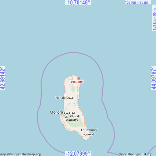
Ivouani GPS coordinates[2]
11° 23' 29.652" South, 43° 23' 40.344" East
| Map corner | latitude | longitude |
|---|---|---|
| Upper-left | -10.70148°, | 42.69142° |
| Center: | -11.39157°, | 43.39454° |
| Lower-right: | -12.07999°, | 44.09767° |
| Map W x H: | 153.3×153.3 km | = 95.3×95.3mi |
| max Lat: | -11.38472° ⇑1.8% North |
| Ivouani: | -11.39157° |
| min Lat: | ⇓98.2% South -12.37306° |
| min Long | Ivouani | max Long |
| 43.2525° | 43.39454° | 44.53194° |
| W 39.8%⇐ | ⇒60.2% E |
Elevation
Elevation of Ivouani is 21 m = 69 ft, and this is 175.1 m = 574 ft below average elevation for this country.
| Max E: |
924 m = 3031 ft | 87.6% |
| Avg. | 196.1 m = 643 ft | |
| Ivouani | 21 m = 69 ft | |
Min E: |
1 m = 3 ft | 12.4% |
See also: Comoros elevation on elevation.city.
Geographical zone
Ivouani is located in South Torrid zone (between Equator and Tropic of Capricorn). Distance of Equator is 1266.6 km =787 mi to North.| Distance of | km | miles | from Ivouani |
|---|---|---|---|
| Equator | 1266.6 | 787 | to North |
| Tropic Capricorn | 1339.3 | 832.2 | to South |
| Antarctic Circle | 6134.6 | 3811.9 | to South |
| South Pole | 8740.4 | 5431 | to South |


Nearby cities:
15 places around Ivouani: (largest is in red/bold)
• Bambadjani
9.9 km =6.2 mi,  191°
191°
• Batou
12.6 km =7.8 mi,  198°
198°
• Bouni
10.6 km =6.6 mi,  183°
183°
• Chezani
4.4 km =2.7 mi, 177°
• Douniani
12 km =7.5 mi,  254°
254°
• Hantsindzi
4.8 km =3 mi,  158°
158°
• Itsandzéni
9.1 km =5.7 mi, 186°
• Koua
13.3 km =8.3 mi,  255°
255°
• Mandza
11.2 km =7 mi, 254°
• Mbéni
12.4 km =7.7 mi, 188°
• Mitsamiouli
12 km =7.5 mi,  273°
273°
• Mnoungou
14.2 km =8.8 mi, 189°
• Ouellah
6.8 km =4.2 mi, 271°
• Ouhozi
12.3 km =7.6 mi, 263°
• Sada-Chihoué
13.3 km =8.3 mi, 188°
Sources, notices
• [Note1] Compared only with cities in Comoros existing in our database
• [Src1] Map data: © OpenStreetMap contributors (CC-BY-SA)
• [Src2] Other city data from geonames.org with taken over terms of usage.
• [Src3] Geographical zone / Annual Mean Temperature by Robert A. Rohde @ Wikipedia
