Sariwŏn geodata
Sariwŏn (Hwanghae-bukto) is a seat of a first-order administrative division; located in North Korea in Asia/Pyongyang (GMT+9) time zone. With population of 310,100 people, there are 8 cities with bigger population in this country. Compared to other cities in North Korea, 90.1% of cities are located further ↑North; 74.7% of cities are located further →East and 70.3% of cities have higher elevation than Sariwŏn. Note1


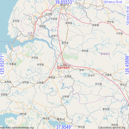
Sariwŏn GPS coordinates[2]
38° 30' 25.992" North, 125° 45' 20.988" East
| Map corner | latitude | longitude |
|---|---|---|
| Upper-left | 39.05533°, | 125.05271° |
| Center: | 38.50722°, | 125.75583° |
| Lower-right: | 37.9549°, | 126.45896° |
| Map W x H: | 122.4×122.4 km | = 76.1×76.1mi |
| max Lat: | 42.95722° ⇑90.1% North |
| Sariwŏn: | 38.50722° |
| min Lat: | ⇓9.9% South 37.90889° |
| min Long | Sariwŏn | max Long |
| 124.39806° | 125.75583° | 130.49522° |
| W 25.3%⇐ | ⇒74.7% E |
Elevation
Elevation of Sariwŏn is 20 m = 66 ft, and this is 111.7 m = 366 ft below average elevation for this country.
| Max E: |
1466 m = 4810 ft | 70.3% |
| Avg. | 131.7 m = 432 ft | |
| Sariwŏn | 20 m = 66 ft | |
Min E: |
1 m = 3 ft | 29.7% |
See also: Sariwŏn elevation on elevation.city.
Geographical zone
Sariwŏn is located in North temperate zone (between Tropic of Cancer and the Arctic Circle). Distance of this Northern Tropic circle is 1675.7 km =1041.2 mi to South.| Distance of | km | miles | from Sariwŏn |
|---|---|---|---|
| North Pole | 5725.5 | 3557.7 | to North |
| Arctic Circle | 3119.6 | 1938.4 | to North |
| Tropic Cancer | 1675.7 | 1041.2 | to South |
| Equator | 4281.6 | 2660.5 | to South |


Nearby cities:
15 places around Sariwŏn: (largest is in red/bold)
• Anak
22.8 km =14.2 mi,  271°
271°
• Ayang-ni
29.4 km =18.3 mi,  175°
175°
• Chaeryŏng-ŭp
17.1 km =10.6 mi,  225°
225°
• Changyŏn
64.2 km =39.9 mi,  243°
243°
• Chunghwa
39.8 km =24.7 mi,  5°
5°
• Haeju
52 km =32.3 mi, 183°
• Hwangju-ŭp
18.2 km =11.3 mi, 5°
• Hŭkkyo-ri
32.6 km =20.3 mi, 5°
• Namp’o
39.6 km =24.6 mi,  310°
310°
• Pyongyang
58.6 km =36.4 mi,  359°
359°
• Pyŏksŏng-ŭp
54 km =33.6 mi,  198°
198°
• Sinmak
42.8 km =26.6 mi,  103°
103°
• Songnim
29.1 km =18.1 mi,  340°
340°
• Sŭngho 1-tong
57.2 km =35.5 mi,  19°
19°
• Yonggang-ŭp
48.3 km =30 mi,  323°
323°
Sources, notices
• [Note1] Compared only with cities in North Korea existing in our database
• [Src1] Map data: © OpenStreetMap contributors (CC-BY-SA)
• [Src2] Other city data from geonames.org with taken over terms of usage.
• [Src3] Geographical zone / Annual Mean Temperature by Robert A. Rohde @ Wikipedia
