Ayang-ni geodata
Ayang-ni (Hwanghae-namdo) is a populated place; located in North Korea in Asia/Pyongyang (GMT+9) time zone. With population of 16,104 people, there are 57 cities with bigger population in this country. Compared to other cities in North Korea, 94.5% of cities are located further ↑North; 72.5% of cities are located further →East and 68.1% of cities have lower elevation than Ayang-ni. Note1


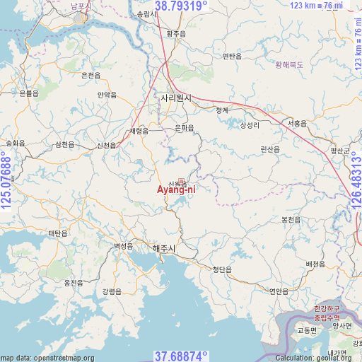
Ayang-ni GPS coordinates[2]
38° 14' 35.016" North, 125° 46' 48" East
| Map corner | latitude | longitude |
|---|---|---|
| Upper-left | 38.79319°, | 125.07688° |
| Center: | 38.24306°, | 125.78° |
| Lower-right: | 37.68874°, | 126.48313° |
| Map W x H: | 122.8×122.8 km | = 76.3×76.3mi |
| max Lat: | 42.95722° ⇑94.5% North |
| Ayang-ni: | 38.24306° |
| min Lat: | ⇓5.5% South 37.90889° |
| min Long | Ayang-ni | max Long |
| 124.39806° | 125.78° | 130.49522° |
| W 27.5%⇐ | ⇒72.5% E |
Elevation
Elevation of Ayang-ni is 107 m = 351 ft, and this is 24.7 m = 81 ft below average elevation for this country.
| Max E: |
1466 m = 4810 ft | 31.9% |
| Avg. | 131.7 m = 432 ft | |
| Ayang-ni | 107 m = 351 ft | |
Min E: |
1 m = 3 ft | 68.1% |
See also: North Korea elevation on elevation.city.
Geographical zone
Ayang-ni is located in North temperate zone (between Tropic of Cancer and the Arctic Circle). Distance of this Northern Tropic circle is 1646.3 km =1023 mi to South.| Distance of | km | miles | from Ayang-ni |
|---|---|---|---|
| North Pole | 5754.8 | 3575.9 | to North |
| Arctic Circle | 3148.9 | 1956.6 | to North |
| Tropic Cancer | 1646.3 | 1023 | to South |
| Equator | 4252.2 | 2642.2 | to South |


Nearby cities:
15 places around Ayang-ni: (largest is in red/bold)
• Anak
38.8 km =24.1 mi,  320°
320°
• Chaeryŏng-ŭp
22.5 km =14 mi, 320°
• Changyŏn
59.7 km =37.1 mi,  270°
270°
• Chunghwa
69.1 km =42.9 mi,  1°
1°
• Haeju
23.2 km =14.4 mi,  194°
194°
• Hwangju-ŭp
47.5 km =29.5 mi,  359°
359°
• Hŭkkyo-ri
61.8 km =38.4 mi, 0°
• Kaesŏng
74.2 km =46.1 mi,  114°
114°
• Namp’o
63.8 km =39.6 mi,  329°
329°
• Ongjin
50.1 km =31.1 mi,  226°
226°
• Pyŏksŏng-ŭp
29.2 km =18.1 mi,  221°
221°
• Sariwŏn
29.4 km =18.3 mi, 355°
• Sinmak
44 km =27.3 mi,  63°
63°
• Songnim
58 km =36 mi,  348°
348°
• Yŏnan-ŭp
49.9 km =31 mi,  138°
138°
Sources, notices
• [Note1] Compared only with cities in North Korea existing in our database
• [Src1] Map data: © OpenStreetMap contributors (CC-BY-SA)
• [Src2] Other city data from geonames.org with taken over terms of usage.
• [Src3] Geographical zone / Annual Mean Temperature by Robert A. Rohde @ Wikipedia
