Namyang-dong geodata
Namyang-dong (Hamgyŏng-bukto) is a populated place; located in North Korea in Asia/Pyongyang (GMT+9) time zone. With population of 22,218 people, there are 42 cities with bigger population in this country. Compared to other cities in North Korea, 98.9% of cities are located further ↓South; 85.7% of cities are located further ←West and 84.6% of cities have lower elevation than Namyang-dong. Note1


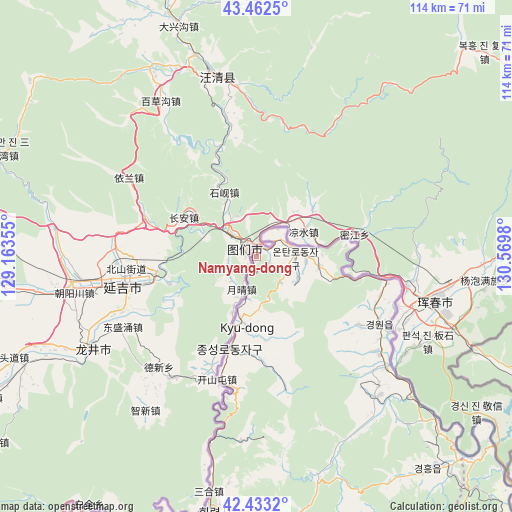
Namyang-dong GPS coordinates[2]
42° 57' 0" North, 129° 52' 0.012" East
| Map corner | latitude | longitude |
|---|---|---|
| Upper-left | 43.4625°, | 129.16355° |
| Center: | 42.95°, | 129.86667° |
| Lower-right: | 42.4332°, | 130.5698° |
| Map W x H: | 114.4×114.4 km | = 71.1×71.1mi |
| max Lat: | 42.95722° ⇑1.1% North |
| Namyang-dong: | 42.95° |
| min Lat: | ⇓98.9% South 37.90889° |
| min Long | Namyang-dong | max Long |
| 124.39806° | 129.86667° | 130.49522° |
| W 85.7%⇐ | ⇒14.3% E |
Elevation
Elevation of Namyang-dong is 281 m = 922 ft, and this is 149.3 m = 490 ft above average elevation for this country.
| Max E: |
1466 m = 4810 ft | 15.4% |
| Namyang-dong | 281 m 922 ft | |
| Avg. | 131.7 m = 432 ft | |
Min E: |
1 m = 3 ft | 84.6% |
See also: North Korea elevation on elevation.city.
Geographical zone
Namyang-dong is located in North temperate zone (between Tropic of Cancer and the Arctic Circle). Distance of this Northern Tropic circle is 2169.7 km =1348.2 mi to South.| Distance of | km | miles | from Namyang-dong |
|---|---|---|---|
| North Pole | 5231.5 | 3250.7 | to North |
| Arctic Circle | 2625.6 | 1631.5 | to North |
| Tropic Cancer | 2169.7 | 1348.2 | to South |
| Equator | 4775.6 | 2967.4 | to South |


Nearby cities:
15 places around Namyang-dong: (largest is in red/bold)
• Aoji
64.2 km =39.9 mi,  137°
137°
• Chungbong
41.4 km =25.7 mi,  177°
177°
• Hahoe-dong
71.4 km =44.4 mi,  133°
133°
• Hoeryŏng
57.4 km =35.7 mi,  189°
189°
• Kogŏnwon
42 km =26.1 mi, 139°
• Kwirak
62.9 km =39.1 mi, 143°
• Kyŏngwŏn
27.8 km =17.3 mi,  123°
123°
• Onsŏng
10.3 km =6.4 mi,  85°
85°
• Ryongdang
38.6 km =24 mi, 130°
• Sambong
29.6 km =18.4 mi, 191°
• Sech’ŏn
41.5 km =25.8 mi, 183°
• Sŏnbong
78.8 km =49 mi,  147°
147°
• Sŏng-dong
64.7 km =40.2 mi,  196°
196°
• Ungsang-nodongjagu
81.9 km =50.9 mi, 143°
• Ŭndŏk
61.3 km =38.1 mi, 141°
Sources, notices
• [Note1] Compared only with cities in North Korea existing in our database
• [Src1] Map data: © OpenStreetMap contributors (CC-BY-SA)
• [Src2] Other city data from geonames.org with taken over terms of usage.
• [Src3] Geographical zone / Annual Mean Temperature by Robert A. Rohde @ Wikipedia
