Dongmyeon geodata
Dongmyeon (Gangwon-do) is a seat of a third-order administrative division; located in South Korea in Asia/Seoul (GMT+9) time zone. In our database, there are 128 cities with bigger population. Compared to other cities in South Korea, 97.9% of cities are located further ↓South; 78.7% of cities are located further ←West and 97.2% of cities have lower elevation than Dongmyeon. Note1


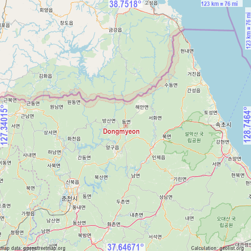
Dongmyeon GPS coordinates[2]
38° 12' 4.86" North, 128° 2' 35.772" East
| Map corner | latitude | longitude |
|---|---|---|
| Upper-left | 38.7518°, | 127.34015° |
| Center: | 38.20135°, | 128.04327° |
| Lower-right: | 37.64671°, | 128.7464° |
| Map W x H: | 122.9×122.9 km | = 76.4×76.4mi |
| max Lat: | 38.37881° ⇑2.1% North |
| Dongmyeon: | 38.20135° |
| min Lat: | ⇓97.9% South 33.25333° |
| min Long | Dongmyeon | max Long |
| 126.10863° | 128.04327° | 129.55377° |
| W 78.7%⇐ | ⇒21.3% E |
Elevation
Elevation of Dongmyeon is 293 m = 961 ft, and this is 222.6 m = 730 ft above average elevation for this country.
| Max E: |
691 m = 2267 ft | 2.8% |
| Dongmyeon | 293 m 961 ft | |
| Avg. | 70.4 m = 231 ft | |
Min E: |
1 m = 3 ft | 97.2% |
See also: South Korea elevation on elevation.city.
Geographical zone
Dongmyeon is located in North temperate zone (between Tropic of Cancer and the Arctic Circle). Distance of this Northern Tropic circle is 1641.7 km =1020.1 mi to South.| Distance of | km | miles | from Dongmyeon |
|---|---|---|---|
| North Pole | 5759.5 | 3578.8 | to North |
| Arctic Circle | 3153.6 | 1959.6 | to North |
| Tropic Cancer | 1641.7 | 1020.1 | to South |
| Equator | 4247.6 | 2639.3 | to South |


Nearby cities:
15 places around Dongmyeon: (largest is in red/bold)
• Bangsan
8.2 km =5.1 mi,  275°
275°
• Cheorwon
72.2 km =44.9 mi,  270°
270°
• Chuncheon
45.3 km =28.1 mi,  216°
216°
• Dongnae
46.4 km =28.8 mi,  212°
212°
• Gapyeong
62.2 km =38.6 mi,  228°
228°
• Gwanin
69.5 km =43.2 mi, 266°
• Haean
12.5 km =7.8 mi,  41°
41°
• Hongch’ŏn
58.3 km =36.2 mi,  193°
193°
• Hwacheon
31.3 km =19.4 mi,  250°
250°
• Kosong
42 km =26.1 mi,  61°
61°
• Seoseok
55.9 km =34.7 mi,  166°
166°
• Sindong
51.4 km =31.9 mi, 213°
• Sokcho
47.9 km =29.8 mi,  89°
89°
• Toseong
45.5 km =28.3 mi,  82°
82°
• Yanggu
11.6 km =7.2 mi,  203°
203°
Sources, notices
• [Note1] Compared only with cities in South Korea existing in our database
• [Src1] Map data: © OpenStreetMap contributors (CC-BY-SA)
• [Src2] Other city data from geonames.org with taken over terms of usage.
• [Src3] Geographical zone / Annual Mean Temperature by Robert A. Rohde @ Wikipedia
