Hongch’ŏn geodata
Hongch’ŏn (Gangwon-do) is a populated place; located in South Korea in Asia/Seoul (GMT+9) time zone. With population of 75,251 people, there are 63 cities with bigger population in this country. Compared to other cities in South Korea, 84.3% of cities are located further ↓South; 75.5% of cities are located further ←West and 86% of cities have lower elevation than Hongch’ŏn. Note1


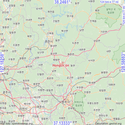
Hongch’ŏn GPS coordinates[2]
37° 41' 30.48" North, 127° 53' 8.52" East
| Map corner | latitude | longitude |
|---|---|---|
| Upper-left | 38.2461°, | 127.18258° |
| Center: | 37.6918°, | 127.8857° |
| Lower-right: | 37.13333°, | 128.58883° |
| Map W x H: | 123.7×123.7 km | = 76.9×76.9mi |
| max Lat: | 38.37881° ⇑15.7% North |
| Hongch’ŏn: | 37.6918° |
| min Lat: | ⇓84.3% South 33.25333° |
| min Long | Hongch’ŏn | max Long |
| 126.10863° | 127.8857° | 129.55377° |
| W 75.5%⇐ | ⇒24.5% E |
Elevation
Elevation of Hongch’ŏn is 137 m = 449 ft, and this is 66.6 m = 219 ft above average elevation for this country.
| Max E: |
691 m = 2267 ft | 14% |
| Hongch’ŏn | 137 m 449 ft | |
| Avg. | 70.4 m = 231 ft | |
Min E: |
1 m = 3 ft | 86% |
See also: Hongch’ŏn elevation on elevation.city.
Geographical zone
Hongch’ŏn is located in North temperate zone (between Tropic of Cancer and the Arctic Circle). Distance of this Northern Tropic circle is 1585 km =984.9 mi to South.| Distance of | km | miles | from Hongch’ŏn |
|---|---|---|---|
| North Pole | 5816.1 | 3614 | to North |
| Arctic Circle | 3210.2 | 1994.7 | to North |
| Tropic Cancer | 1585 | 984.9 | to South |
| Equator | 4190.9 | 2604.1 | to South |


Nearby cities:
15 places around Hongch’ŏn: (largest is in red/bold)
• Cheongpyeong
41.5 km =25.8 mi,  276°
276°
• Chuncheon
24.3 km =15.1 mi,  326°
326°
• Dongnae
20.5 km =12.7 mi, 327°
• Gapyeong
36.4 km =22.6 mi,  295°
295°
• Hwacheon
48.8 km =30.3 mi,  341°
341°
• Hwado
51.1 km =31.8 mi,  265°
265°
• Pubal
55.6 km =34.5 mi,  216°
216°
• Pyeongchang
57.3 km =35.6 mi,  128°
128°
• Seoseok
26.6 km =16.5 mi,  85°
85°
• Sindong
20.4 km =12.7 mi,  313°
313°
• Su-dong
49.3 km =30.6 mi, 271°
• Wŏnju
38.2 km =23.7 mi,  172°
172°
• Yanggu
46.9 km =29.1 mi,  11°
11°
• Yangp'yŏng
41.4 km =25.7 mi,  237°
237°
• Yeoju
49.3 km =30.6 mi,  206°
206°
Sources, notices
• [Note1] Compared only with cities in South Korea existing in our database
• [Src1] Map data: © OpenStreetMap contributors (CC-BY-SA)
• [Src2] Other city data from geonames.org with taken over terms of usage.
• [Src3] Geographical zone / Annual Mean Temperature by Robert A. Rohde @ Wikipedia
