Gapyeong geodata
Gapyeong (Gyeonggi-do) is a populated place; located in South Korea in Asia/Seoul (GMT+9) time zone. With population of 55,415 people, there are 81 cities with bigger population in this country. Compared to other cities in South Korea, 93.4% of cities are located further ↓South; 60.8% of cities are located further ←West and 65.4% of cities have lower elevation than Gapyeong. Note1


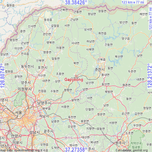
Gapyeong GPS coordinates[2]
37° 49' 51.636" North, 127° 30' 38.124" East
| Map corner | latitude | longitude |
|---|---|---|
| Upper-left | 38.38426°, | 126.80747° |
| Center: | 37.83101°, | 127.51059° |
| Lower-right: | 37.27358°, | 128.21372° |
| Map W x H: | 123.5×123.5 km | = 76.7×76.7mi |
| max Lat: | 38.37881° ⇑6.6% North |
| Gapyeong: | 37.83101° |
| min Lat: | ⇓93.4% South 33.25333° |
| min Long | Gapyeong | max Long |
| 126.10863° | 127.51059° | 129.55377° |
| W 60.8%⇐ | ⇒39.2% E |
Elevation
Elevation of Gapyeong is 67 m = 220 ft, and this is 3.4 m = 11 ft below average elevation for this country.
| Max E: |
691 m = 2267 ft | 34.6% |
| Avg. | 70.4 m = 231 ft | |
| Gapyeong | 67 m = 220 ft | |
Min E: |
1 m = 3 ft | 65.4% |
See also: Gapyeong elevation on elevation.city.
Geographical zone
Gapyeong is located in North temperate zone (between Tropic of Cancer and the Arctic Circle). Distance of this Northern Tropic circle is 1600.5 km =994.5 mi to South.| Distance of | km | miles | from Gapyeong |
|---|---|---|---|
| North Pole | 5800.6 | 3604.3 | to North |
| Arctic Circle | 3194.8 | 1985.2 | to North |
| Tropic Cancer | 1600.5 | 994.5 | to South |
| Equator | 4206.4 | 2613.7 | to South |


Nearby cities:
15 places around Gapyeong: (largest is in red/bold)
• Cheongpyeong
13.4 km =8.3 mi,  217°
217°
• Chuncheon
20.2 km =12.6 mi,  76°
76°
• Dongnae
22.1 km =13.7 mi,  85°
85°
• Guri-si
41.6 km =25.8 mi,  231°
231°
• Hongch’ŏn
36.4 km =22.6 mi,  115°
115°
• Hwacheon
35.2 km =21.9 mi,  29°
29°
• Hwado
26.7 km =16.6 mi, 221°
• Jinjeop
30.5 km =19 mi,  247°
247°
• Namyangju
33.9 km =21.1 mi, 230°
• Onam
30.6 km =19 mi,  241°
241°
• Sindong
18.2 km =11.3 mi, 94°
• Su-dong
21.6 km =13.4 mi, 228°
• Wabu
37 km =23 mi, 223°
• Yangju
39.4 km =24.5 mi,  270°
270°
• Yangp'yŏng
38 km =23.6 mi,  182°
182°
Sources, notices
• [Note1] Compared only with cities in South Korea existing in our database
• [Src1] Map data: © OpenStreetMap contributors (CC-BY-SA)
• [Src2] Other city data from geonames.org with taken over terms of usage.
• [Src3] Geographical zone / Annual Mean Temperature by Robert A. Rohde @ Wikipedia
