El Hermel geodata
El Hermel (Baalbek-Hermel) is a seat of a second-order administrative division; located in Lebanon in Asia/Beirut (GMT+3) time zone. In our database, there are 19 cities with bigger population. Compared to other cities in Lebanon, 90.6% of cities are located further ↓South; 100% of cities are located further ←West and 53.1% of cities have lower elevation than El Hermel. Note1


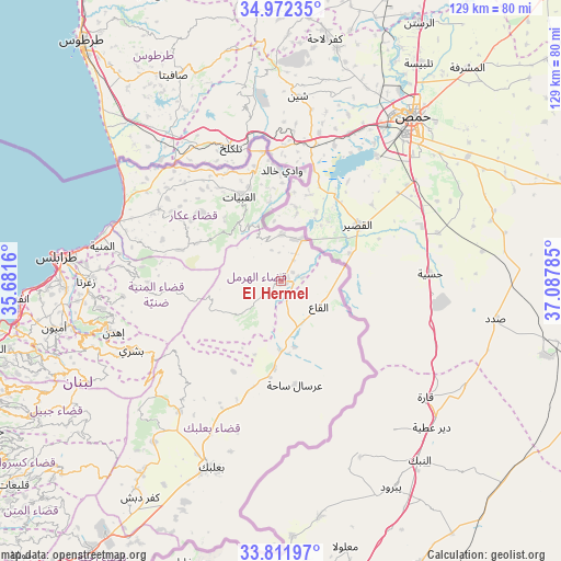
El Hermel GPS coordinates[2]
34° 23' 39.012" North, 36° 23' 4.992" East
| Map corner | latitude | longitude |
|---|---|---|
| Upper-left | 34.97235°, | 35.6816° |
| Center: | 34.39417°, | 36.38472° |
| Lower-right: | 33.81197°, | 37.08785° |
| Map W x H: | 129×129 km | = 80.2×80.2mi |
| max Lat: | 34.54278° ⇑9.4% North |
| El Hermel: | 34.39417° |
| min Lat: | ⇓90.6% South 33.11023° |
| min Long | El Hermel | max Long |
| 35.13972° | 36.38472° | 36.38472° |
| W 100%⇐ | ⇒0% E |
Elevation
Elevation of El Hermel is 743 m = 2438 ft, and this is 187.8 m = 616 ft above average elevation for this country.
| Max E: |
1442 m = 4731 ft | 46.9% |
| El Hermel | 743 m 2438 ft | |
| Avg. | 555.2 m = 1822 ft | |
Min E: |
7 m = 23 ft | 53.1% |
See also: Lebanon elevation on elevation.city.
Geographical zone
El Hermel is located in North temperate zone (between Tropic of Cancer and the Arctic Circle). Distance of this Northern Tropic circle is 1218.4 km =757.1 mi to South.| Distance of | km | miles | from El Hermel |
|---|---|---|---|
| North Pole | 6182.8 | 3841.8 | to North |
| Arctic Circle | 3576.9 | 2222.6 | to North |
| Tropic Cancer | 1218.4 | 757.1 | to South |
| Equator | 3824.3 | 2376.3 | to South |


Nearby cities:
15 places around El Hermel: (largest is in red/bold)
• Aanjar
85.1 km =52.9 mi,  209°
209°
• Amioûn
53.9 km =33.5 mi,  258°
258°
• Baalbek
45.8 km =28.5 mi,  199°
199°
• Batroûn
68.5 km =42.6 mi, 256°
• Bcharré
37.9 km =23.5 mi,  245°
245°
• Bhamdoun
94.9 km =59 mi,  225°
225°
• Bhamdoûn el Mhatta
93.2 km =57.9 mi, 225°
• Halba
32.5 km =20.2 mi,  300°
300°
• Jbaïl
74.2 km =46.1 mi, 245°
• Jdaidet el Matn
93.8 km =58.3 mi, 233°
• Jounieh
84.2 km =52.3 mi,  236°
236°
• Sîr ed Danniyé
32.5 km =20.2 mi,  268°
268°
• Tripoli
49.8 km =30.9 mi,  275°
275°
• Zahlé
75.4 km =46.9 mi,  216°
216°
• Zghartā
44.9 km =27.9 mi, 270°
Sources, notices
• [Note1] Compared only with cities in Lebanon existing in our database
• [Src1] Map data: © OpenStreetMap contributors (CC-BY-SA)
• [Src2] Other city data from geonames.org with taken over terms of usage.
• [Src3] Geographical zone / Annual Mean Temperature by Robert A. Rohde @ Wikipedia
