Zahlé geodata
Zahlé (Béqaa) is a seat of a first-order administrative division; located in Lebanon in Asia/Beirut (GMT+3) time zone. With population of 78,145 people, there are 8 cities with bigger population in this country. Compared to other cities in Lebanon, 56.3% of cities are located further ↓South; 81.3% of cities are located further ←West and 84.4% of cities have lower elevation than Zahlé. Note1


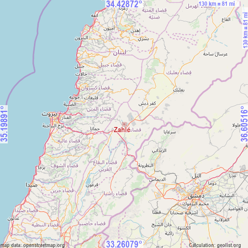
Zahlé GPS coordinates[2]
33° 50' 48.3" North, 35° 54' 7.308" East
| Map corner | latitude | longitude |
|---|---|---|
| Upper-left | 34.42872°, | 35.19891° |
| Center: | 33.84675°, | 35.90203° |
| Lower-right: | 33.26079°, | 36.60516° |
| Map W x H: | 129.9×129.9 km | = 80.7×80.7mi |
| max Lat: | 34.54278° ⇑43.7% North |
| Zahlé: | 33.84675° |
| min Lat: | ⇓56.3% South 33.11023° |
| min Long | Zahlé | max Long |
| 35.13972° | 35.90203° | 36.38472° |
| W 81.3%⇐ | ⇒18.7% E |
Elevation
Elevation of Zahlé is 963 m = 3159 ft, and this is 407.8 m = 1338 ft above average elevation for this country.
| Max E: |
1442 m = 4731 ft | 15.6% |
| Zahlé | 963 m 3159 ft | |
| Avg. | 555.2 m = 1822 ft | |
Min E: |
7 m = 23 ft | 84.4% |
See also: Zahlé elevation on elevation.city.
Geographical zone
Zahlé is located in North temperate zone (between Tropic of Cancer and the Arctic Circle). Distance of this Northern Tropic circle is 1157.5 km =719.2 mi to South.| Distance of | km | miles | from Zahlé |
|---|---|---|---|
| North Pole | 6243.7 | 3879.7 | to North |
| Arctic Circle | 3637.8 | 2260.4 | to North |
| Tropic Cancer | 1157.5 | 719.2 | to South |
| Equator | 3763.4 | 2338.5 | to South |


Nearby cities:
15 places around Zahlé: (largest is in red/bold)
• Aaley
28.3 km =17.6 mi,  260°
260°
• Aanjar
13.5 km =8.4 mi,  168°
168°
• Baabda
33.1 km =20.6 mi,  267°
267°
• Baalbek
34.1 km =21.2 mi,  58°
58°
• Beirut
37.3 km =23.2 mi,  277°
277°
• Beït ed Dîne
34.2 km =21.3 mi,  240°
240°
• Bhamdoun
23.9 km =14.9 mi, 256°
• Bhamdoûn el Mhatta
22.8 km =14.2 mi, 259°
• Jbaïl
38.5 km =23.9 mi,  322°
322°
• Jdaidet el Matn
31.4 km =19.5 mi, 278°
• Jezzîne
44.9 km =27.9 mi,  220°
220°
• Joubb Jannîne
26.8 km =16.7 mi,  204°
204°
• Jounieh
30.2 km =18.8 mi,  299°
299°
• Ra’s Bayrūt
39.1 km =24.3 mi, 278°
• Râchaïya el Ouadi
38.8 km =24.1 mi,  187°
187°
Sources, notices
• [Note1] Compared only with cities in Lebanon existing in our database
• [Src1] Map data: © OpenStreetMap contributors (CC-BY-SA)
• [Src2] Other city data from geonames.org with taken over terms of usage.
• [Src3] Geographical zone / Annual Mean Temperature by Robert A. Rohde @ Wikipedia
